Can Navigation Ability Be Improved?
Chuanxiuyue (Carol) He and Mary Hegarty
Department of Psychological and Brain Sciences, University of California, Santa Barbara
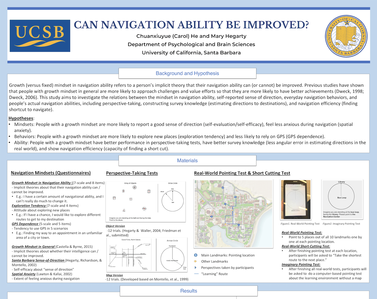
Growth (versus fixed) mindset in navigation ability refers to a person’s implicit theory that their navigation ability can (or cannot) be improved. Previous studies have shown that people with growth mindset in general are more likely to approach challenges and value efforts so that they are more likely to have better achievements (Dweck, 1998; Dweck, 2006). This study aims to investigate the relations between the mindset in navigation ability, self-reported sense of direction, everyday navigation behaviors, and people’s actual navigation abilities, including perspective-taking, constructing survey knowledge (estimating directions to destinations), and navigation efficiency (finding shortcut to navigate).
Effects of Climate Change and Urbanization on Joshua Trees
Shelly Hill, Moriah Mason, and Christine Pang
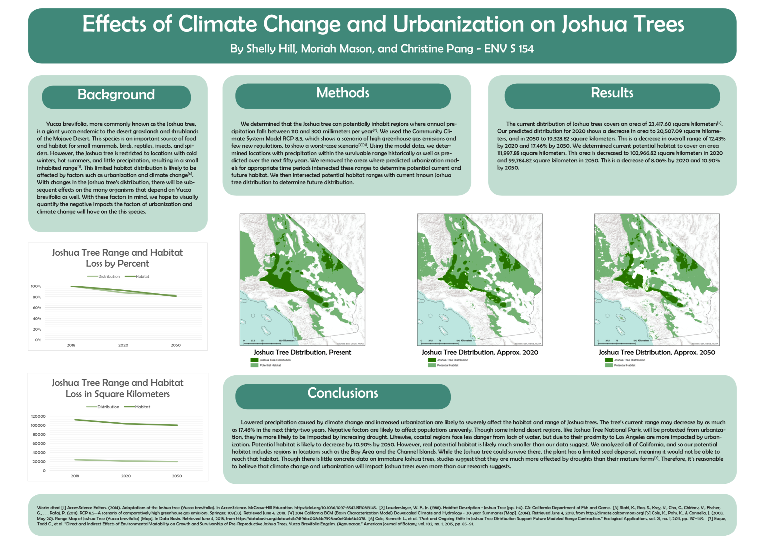
Yucca brevifolia, more commonly known as the Joshua tree, is a giant yucca endemic to the desert grasslands and shrublands of the Mojave Desert. This species is an important source of food and habitat for small mammals, birds, reptiles, insects, and spiders. However, the Joshua tree is restricted to locations with cold winters, hot summers, and little precipitation, resulting in a small inhabited range. This limited habitat distribution is likely to be affected by factors such as urbanization and climate change. With changes in the Joshua tree’s distribution, there will be subsequent effects on the many organisms that depend on Yucca brevifolia as well. With these factors in mind, we hope to visually quantify the negative impacts the factors of urbanization and climate change will have on the this species.
Expanding UCSB Sustainability’s Urban Orchard Program
Thomas Crimmel, Adriana Ocasio, Yixue Meng, Thomas Smith
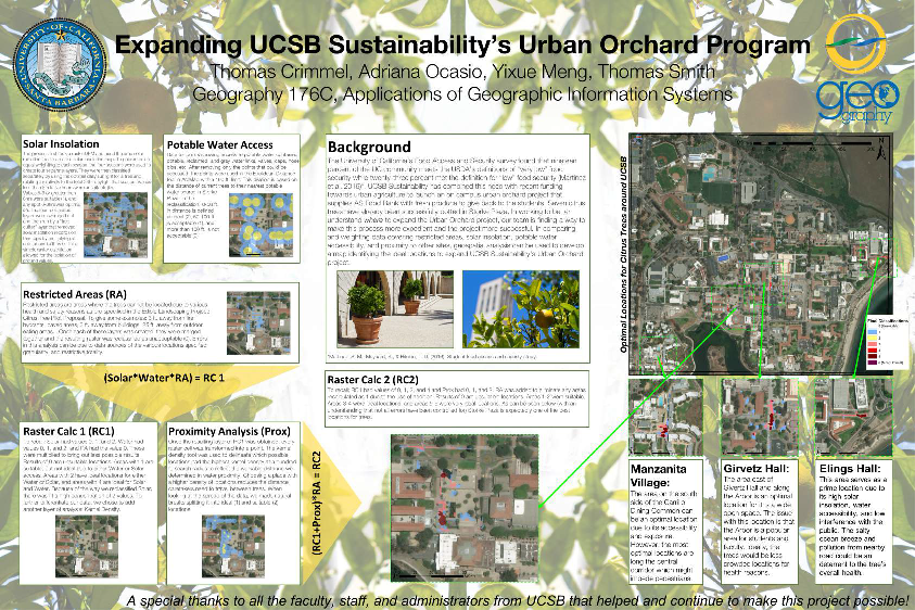
The University of California’s Food Access and Security survey found that nineteen percent of the UC community meets the USDA’s definitions of “very low” food security while twenty-three percent met the definition for “low” food security (Martinez et al. 2016). UCSB Sustainability has combined this need with recent funding towards urban agriculture to launch an on campus urban orchard project that supplies AS Food Bank with fresh produce to give back to the students. Seven citrus trees have already been successfully potted in Storke Plaza. In working to better understand where to expand the Urban Orchard project, our team is finding a way to make this process more expedient and the project more successful. In comparing and weighting data covering restricted areas, solar insolation, potable water accessibility, and proximity to other sites, geospatial analysis can be used to develop a map identifying the ideal locations to expand UCSB Sustainability’s Urban Orchard project.
How to test hypotheses with geographic prisms
Thomas Crimmel, Thomas Hervey, Pyry Kettunen, Sara Lafia, Christina Last, Behzad Vahedi, Jingyi Xiao, & Werner Kuhn
The Center for Spatial Studies, University of California, Santa Barbara
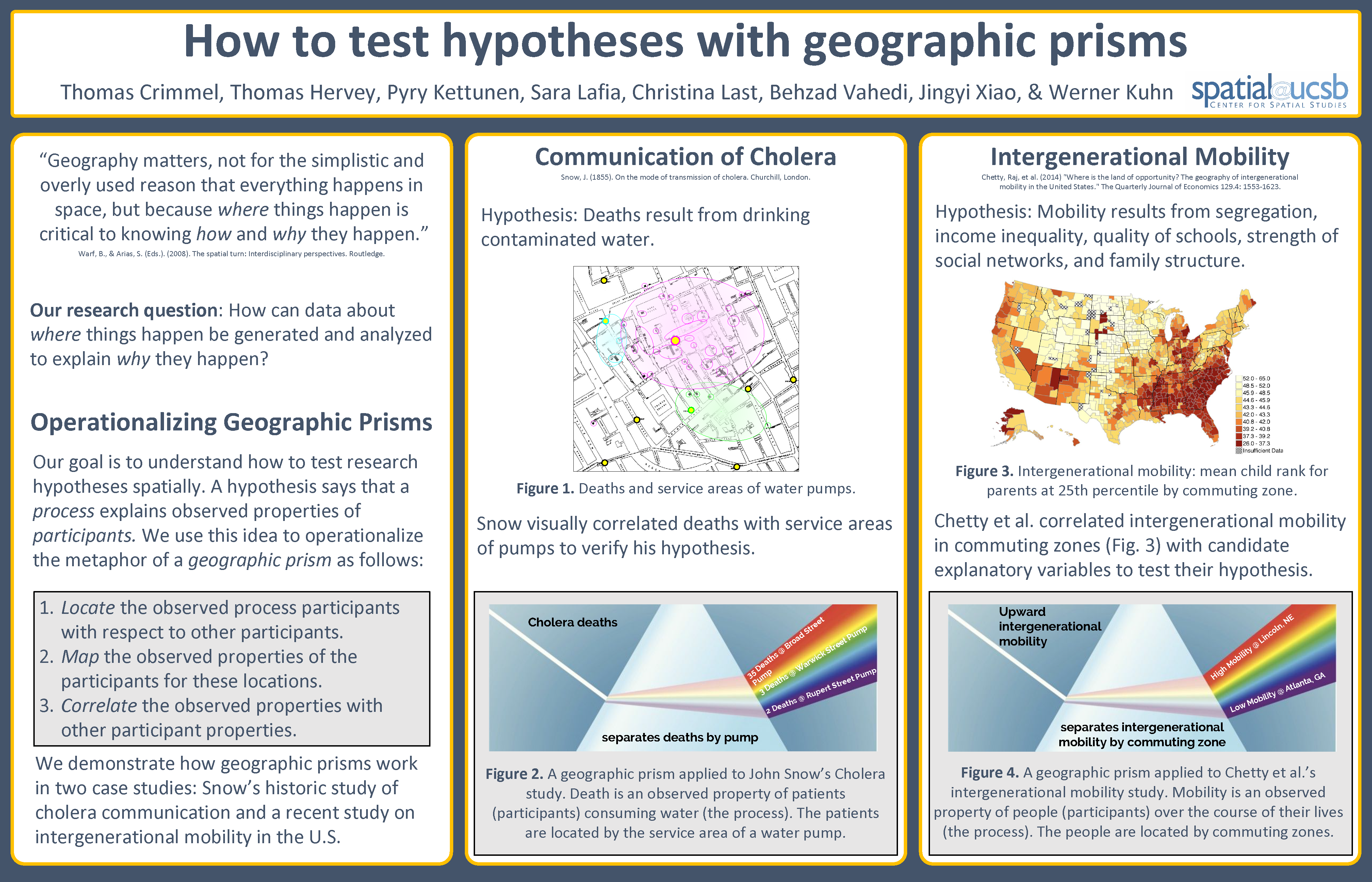
Our goal is to understand how to test research hypotheses spatially. A hypothesis says that a process explains observed properties of participants. We use this idea to operationalize the metaphor of a geographic prism as follows:
1. Locate the observed process participants with respect to other participants. 2. Map the observed properties of the participants for these locations. 3. Correlate the observed properties with other participant properties.
Hurricane Harvey: Spatial Analysis Using Twitter
Gabriel Hernandez, Lisa Nguyen, Annie Satalich, Alyssa White
University of California, Santa Barbara
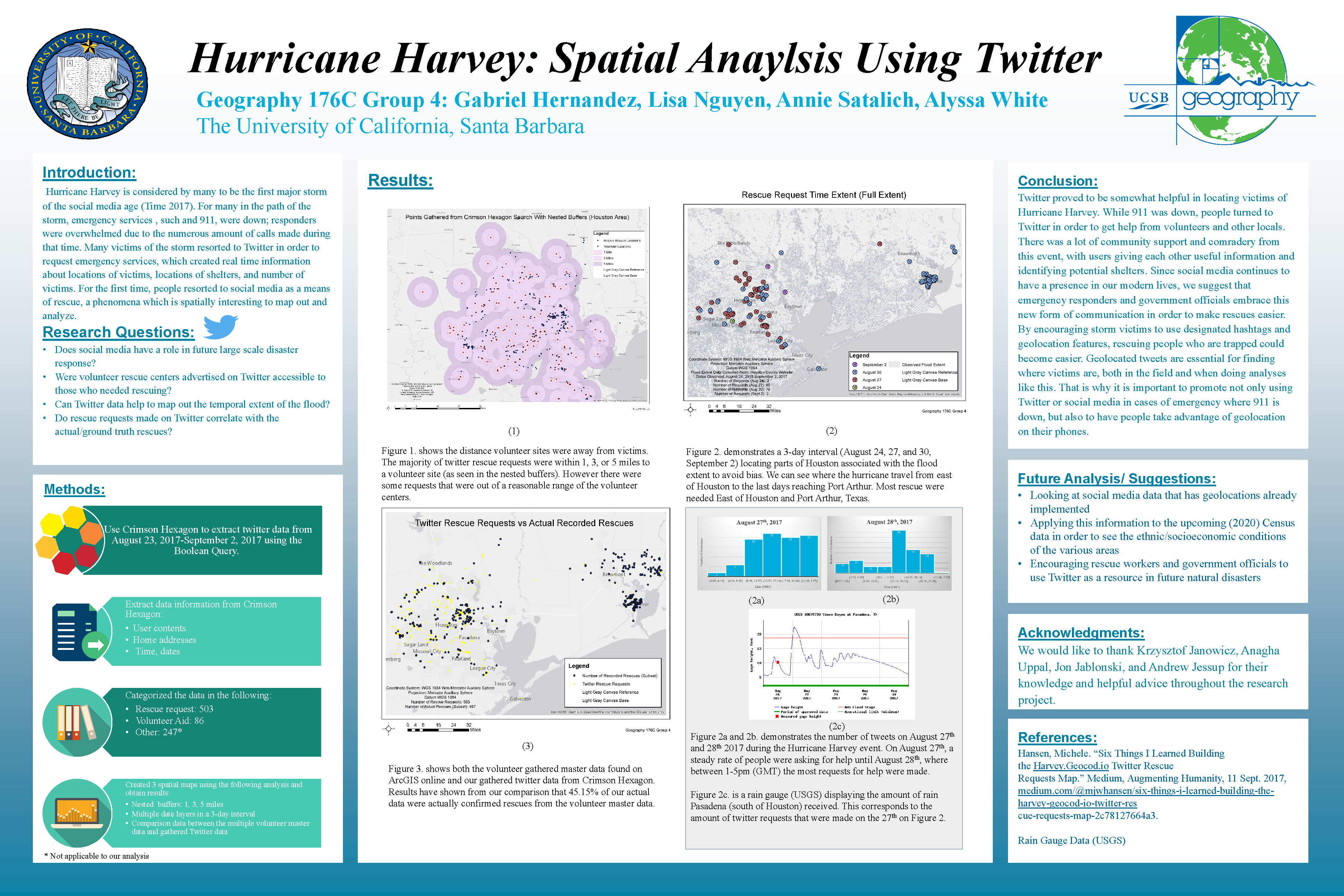
Hurricane Harvey is considered by many to be the first major storm of the social media age (Time 2017). For many in the path of the storm, emergency services, such as 911, were down; responders were overwhelmed due to the numerous amount of calls made during that time. Many victims of the storm resorted to Twitter in order to request emergency services, which created real time information about locations of victims, locations of shelters, and number of victims. For the first time, people resorted to social media as a means of rescue, a phenomena which is spatially interesting to map out and analyze.
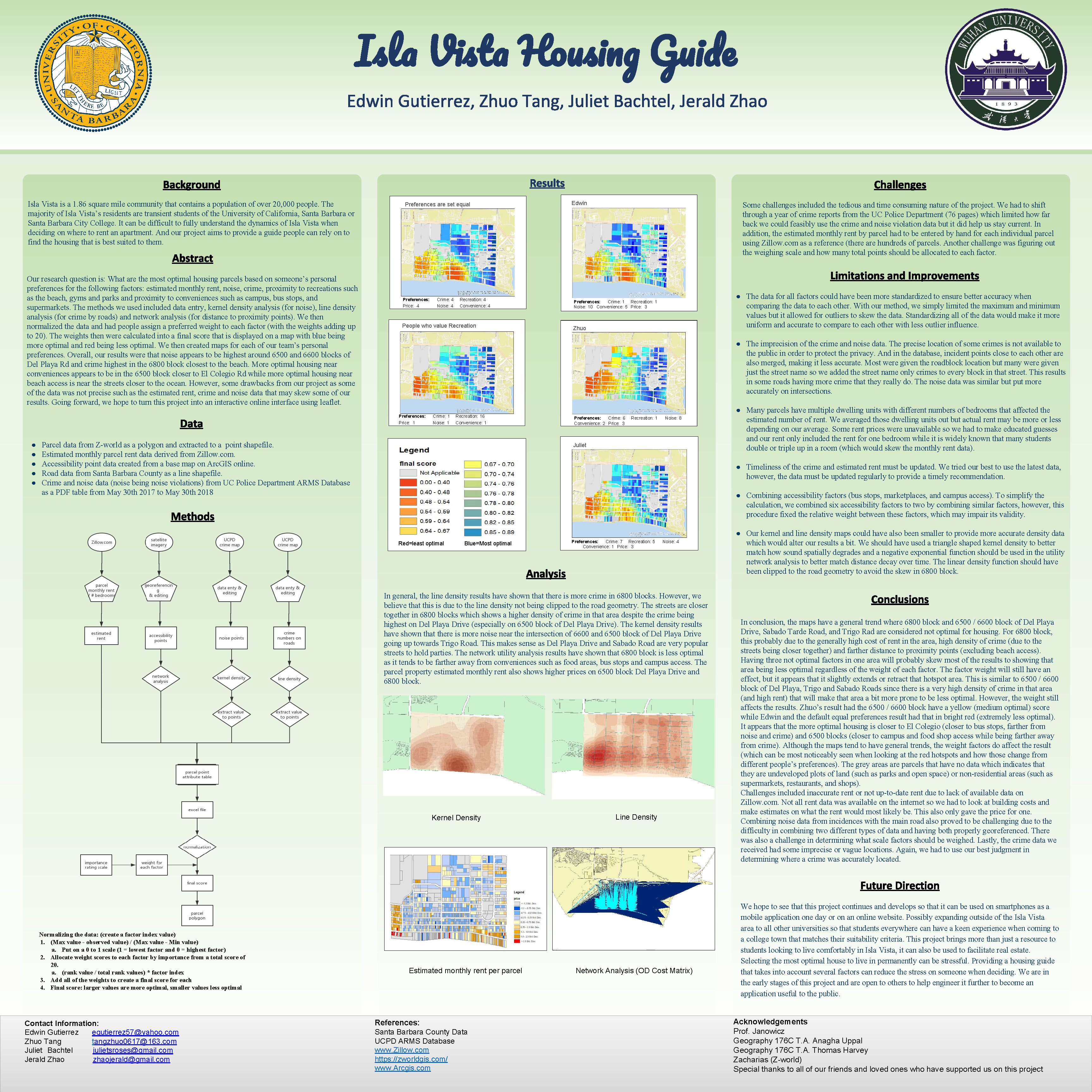
Isla Vista Housing Guide
Edwin Guterriez, Zhuo Tang, Juliet Bachtel, Jerald Zhao
Department of Geography, University of California, Santa Barbara and Wuhan University
Isla Vista is a 1.86 square mile community that contains a population of over 20,000 people. The majority of Isla Vista’s residents are transient students of the University of California, Santa Barbara or Santa Barbara City College. It can be difficult to fully understand the dynamics of Isla Vista when deciding on where to rent an apartment. And our project aims to provide a guide people can rely on to find the housing that is best suited to them.
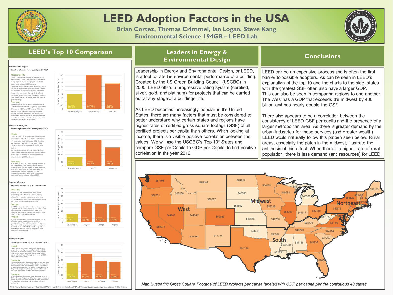
LEED Adoption Factors in the USA
Brian Cortez, Thomas Crimmel, Ian Logan, Steve Kang
University of California, Santa Barbara
Leadership in Energy and Environmental Design, or LEED, is a tool to rate the environmental performance of a building. Created by the US Green Building Council (USGBC) in 2000, LEED offers a progressive rating system (certified, silver, gold, and platinum) for projects that can be carried out at any stage of a buildings life.
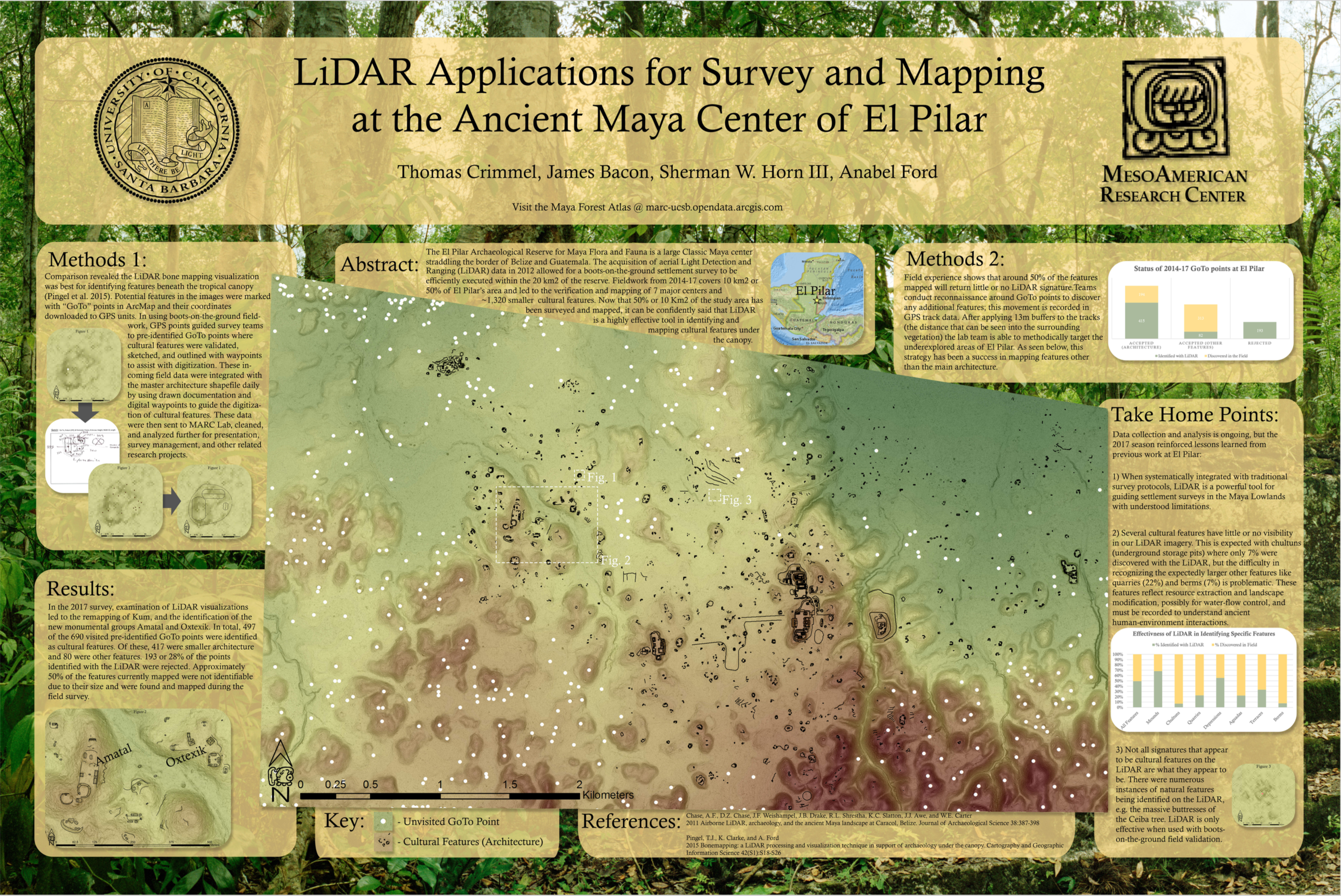
LiDAR Applications for Survey and Mapping at the Ancient Maya Center of El Pilar
Thomas Crimmel, James Bacon, Sherman W. Horn III, Anabel Ford
MesoAmerican Research Center, University of California, Santa Barbara
The El Pilar Archaeological Reserve for Maya Flora and Fauna is a large Classic Maya center straddling the border of Belize and Guatemala. The acquisition of aerial Light Detection and Ranging (LiDAR) data in 2012 allowed for a boots-on-the-ground settlement survey to be efficiently executed within the 20 km2 of the reserve. Fieldwork from 2014-17 covers 10 km2 or 50% of El Pilar’s area and led to the verification and mapping of 7 major centers and ~1,320 smaller cultural features. Now that 50% or 10 Km2 of the study area has been surveyed and mapped, it can be confidently said that LiDAR is a highly effective tool in identifying and mapping cultural features under the canopy.
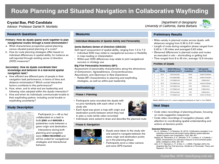
Route Planning and Situated Navigation in Collaborative Wayfinding
Crystal Bae
Department of Geography, University of California, Santa Barbara
Participants collaborated on a task to both plan and execute a route in a novel environment. In the planning phase of this study, each dyad was given start and end points on a paper map between which they had to devise a route to take. In the second part of the study, each dyad was taken to the study site where they navigated together between the origin and destination points while being video-recorded and GPS-tracked. Using this rich repository of video-recorded interaction alongside collected data on participants’ navigational planning and performance, I investigate strategies of social role-taking, the collaborative use of environmental cues and references, and the communication of uncertainty in wayfinding.
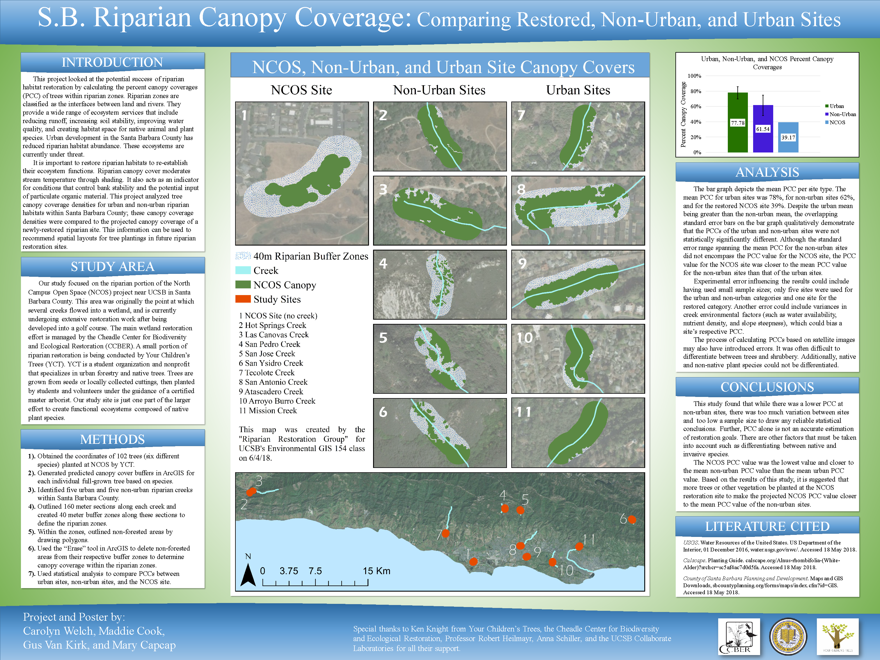
S.B. Riparian Canopy Coverage: Comparing Restored, Non-Urban, and Urban Sites
Carolyn Welch, Maddie Cook, Gus Van Kirk, and Mary Capcap
University of California, Santa Barbara
This project looked at the potential success of riparian habitat restoration by calculating the percent canopy coverages (PCC) of trees within riparian zones. Riparian zones are classified as the interfaces between land and rivers. They provide a wide range of ecosystem services that include reducing runoff, increasing soil stability, improving water quality, and creating habitat space for native animal and plant species. Urban development in the Santa Barbara County has reduced riparian habitat abundance. These ecosystems are currently under threat.
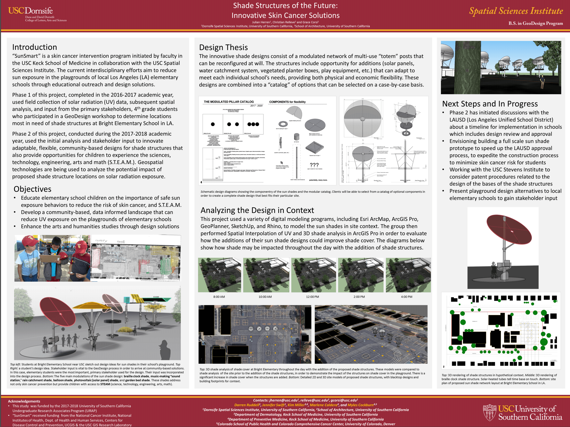
Shade Structures of the Future: Innovative Skin Cancer Solutions
Julian Herren, Christian Lance Relleve and Grace Corsi
University of Southern California
“SunSmart” is a skin cancer intervention program initiated by faculty in the USC Keck School of Medicine in collaboration with the USC Spatial Sciences Institute. The current interdisciplinary efforts aim to reduce sun exposure in the playgrounds of local Los Angeles (LA) elementary schools through educational outreach and design solutions.
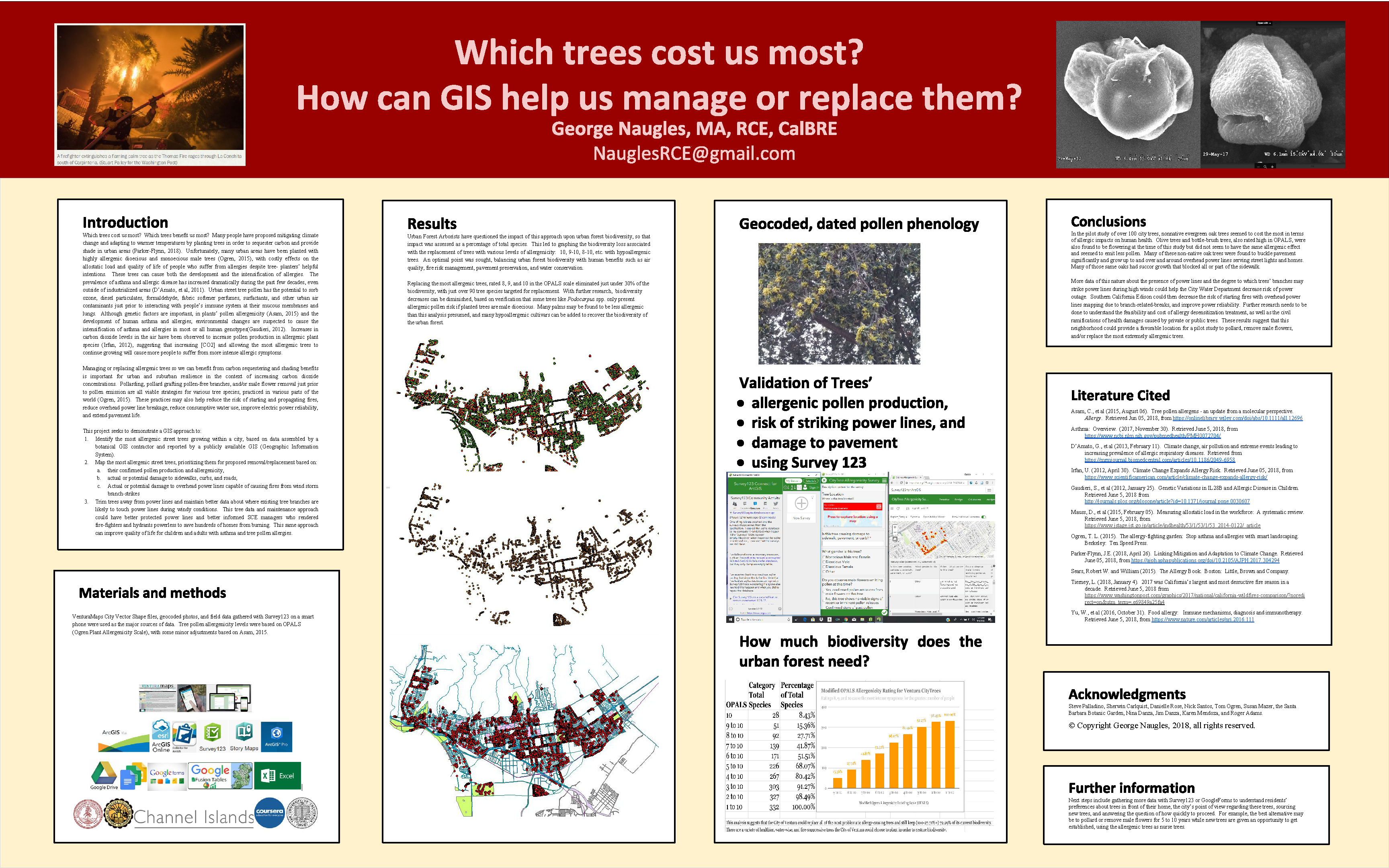
Which trees cost us most? How can GIS help us manage or replace them?
George Naugles, MA, RCE, CalBRE
This project seeks to demonstrate a GIS approach to identify the most allergenic street trees growing within a city, based on data assembled by a botanical GIS contractor and reported by a publicly available GIS (Geographic Information System).

