Press release from the OpenStreetMap Foundation
Map volunteers help Haiti Search & Rescue – 24th January 2010
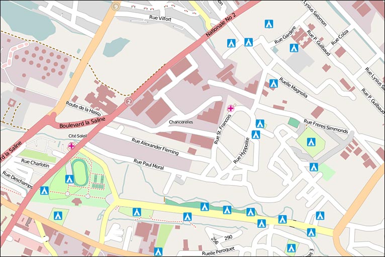
Volunteers from OpenStreetMap.org – the website dubbed “the Free Wiki World Map” – are providing essential maps to Search & Rescue and Relief teams responding to the Haiti earthquake. A lack of up to date post-disaster maps of the region hamper SAR teams’ efforts to reach collapsed buildings and makeshift refugee camps. But, since the earthquake, OpenStreetMap volunteers have used daily updates of satellite imagery to plot an accurate map of the latest situation in Haiti. These maps show those roads which are still passable; hospitals; refugee camps; and – a stark but urgent need – cemeteries. The maps are being printed out by aid workers, and also downloaded onto hand-held GPS units.
One SAR worker from Virginia, USA, told the project: “I wish there was a way that I can express to you how important your OSM files were to us. Having these detailed maps on our GPS units is a big deal. We transferred the street level maps onto as many Garmin units as we could before sending the American rescue teams on the streets. The team members are thrilled to have this resource you have created. Their faces ‘light up’ when I take their GPS unit and tell them that I’m going to give them street level detail maps.” The OpenStreetMap volunteers began working on the map immediately after the earthquake struck, enabling, for example, the World Food Programme to use the map in their initial damage assessment. Now, as aid arrives in the country, the mappers are expanding their work to include key routes from the Dominican Republic.
OpenStreetMap.org is a map website with an ‘Edit’ button, where anyone can use their knowledge to improve the map of their local area. Thousands of its volunteers across the world, from Iceland to the Philippines, have now switched their attention from their own countries to Haiti. E-mail messages forwarded from aid workers are helping OpenStreetMap’s volunteers to prioritise their work where it is most needed. The work would not have been possible without the generous provision of aerial imagery by GeoEye, DigitalGlobe, Spot, ErosB, and Google. The latest images are available for mappers to use in under 24 hours from the satellite capture. City maps provided by the New York Public Library, UN, US Government, and European Commission, among others, are helping mappers to name each street.
Grad student Alan Glennon provided the following information regarding UCSB Geography’s role in OSM: “Several UCSB geographers are OpenStreetMap (OSM) Foundation members and contributors, which is a reason UCSB/Isla Vista has a more detailed open source map than downtown Los Angeles. Spatial@ucsb and CrisisCommons.org hosted an OSM volunteer workday (Crisis Camp Santa Barbara) at UCSB on Saturday 2/20. Most of the work was applying the technology created and lessons learned from the OSM Haiti coordination to our local area. Workday volunteers included Micah Brachman, Jason Burgdorfer, Chad Catacchio (Crisiscommons.org), Zach Chehayeb, Kitty Currier, Andrew Fox (USDA APHIS), Linna Li, Alan Glennon, Rhonda Glennon (ESRI), and Nick Santos. Chad and Linna worked on online tools and workflows to better share real-time crisis information. Geography undergraduates Jason, Zach, and Nick made great strides in an open source map of Santa Barbara-area police, fire, and medical facilities. Results and project updates can be found at: http://osm.org and http://crisiscommons.org.”
Editor’s note: BBC News Magazine currently features an excellent slideshow of the use of OpenStreetMap in Haiti titled “The volunteer mappers who helped Haiti.” For more about Haiti’s earthquake, see the article of January 15: “Haiti: Geography Matters.” For more about the phenomenon of volunteer mapping, see the article of December 7, 2009, “Goodchild Quoted in New York Times Article on VGI.”