The following letter from our esteemed Chair, Dan Montello, was initially written for the UCSB Geography Fall Newsletter and was titled “What I Did for My Summer Vacation”:
It is my pleasure to offer this, my first “Letter from the Chair.” I started in my new position as Chair of the Department of Geography last July. My duties started right away; thus, last summer was even busier than summer normally is. Like for other faculty members, summer for me is typically an opportunity to push my research along, including designing studies, collecting and analyzing data, conferring with collaborators, and writing, writing, writing. Since July, I have certainly spent more of my time carrying out the myriad administrative tasks that are part of being Chair.
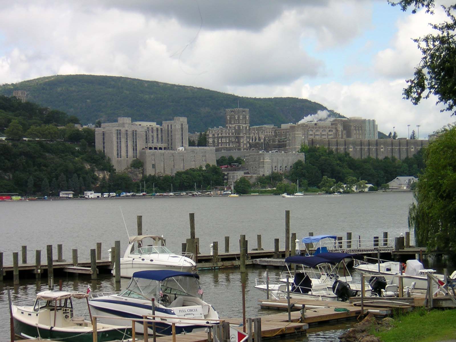
So, of course, the title of this letter is a little misleading. I did not really take a summer vacation. But I did manage to combine some vacation time with a research trip. During the last week of July, I traveled to West Point, New York, home to the United States Military Academy (USMA), the Army’s main school for training officers for over 200 years (and long an estimable engineering school as well) . Along with Ian Irmischer, doctoral student in Geography, and Mary Hegarty, Professor in Psychological & Brain Sciences, I have started researching the navigation training that takes place at the USMA and the navigational abilities of its cadets (undergraduates). Our major scientific goals are to improve our understanding of how and why people differ from each other in navigational reasoning and abilities, how the training procedures and materials used by the Army work (or don’t), and how we might improve this training. Each summer, over 1,000 incoming freshman cadets go through intensive training in land navigation techniques (among other skills and knowledge). This training is not about using a computerized GPS-enabled navigation system. It’s two days of training in the detailed reading of topographic maps (that show landforms, water bodies, and so on); the precise use of the magnetic compass, coordinate scale, and protractor; the assessment of walked distances; the planning of efficient routes; and more.
The thousand-plus cadets are organized into several smaller groups, each undergoing the same four days of training, but staggered to start on different days. The first two days involve classroom study and lecture, including using coordinates (derived from the lat-long system) to plot the control points they will later search for in the field. Among other things, cadets are trained to imagine 3-D landforms when presented with a pattern of contour lines on a flat topo map. At the end of the second day, they spend time in a virtual-reality training lab, which is essentially a first-person shooter video game without the shooting but with simulated travel over a landscape, using virtual versions of the same tools they will use the next day in the field. (Researchers in my area of study have been using virtual reality as a research tool since the early 1990s.) On the third and fourth days, the cadets find themselves in the field setting, which is on the 16,000-acre semi-wilderness “campus” that is part of West Point but away from the central campus buildings and football stadium. They bivouacked outside the previous night (yes, in the rain) and ate MREs for all their meals (I tried them—they’re much better than some of the food I have had in more than one cafeteria or diner). In the field, cadets are tasked to walk with backpacks to the control points they previously analyzed in the classroom. The points are marked with 3-ft sticks topped with flags; they are fairly inconspicuous until you get pretty close to them. Although the cadets’ locations are constantly tracked by their supervisors with GPS-enabled phones while they hike around the several-km long course, the cadets themselves do not use the GPS to localize. They are awarded credit for quickly and accurately finding the required control points. Meanwhile, a GPS-derived record of their travel routes, with time stamps, is recorded. That provides a rich and important source of data for me and my colleagues.
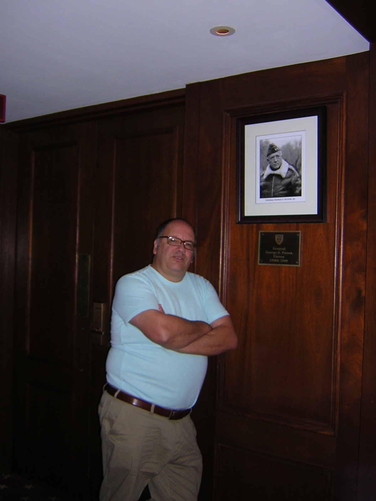
And my vacation? Part of it took place Sunday morning, when I tried my hand (and my eyes, mind, and feet) at hiking to control points, as the cadets were doing. That was really mixing business and pleasure! But after finding the second point, a storm rushed over Ian and me (that too is pleasant when you’ve come from a dry Mediterranean summer), and so we called it a day. Also enjoyable was the chance to learn about such an interesting procedure from the officers in charge of this program and some helpful cadet informants. I found it appealing to consider that I might be able to help improve the training. But probably most pleasurable was just visiting West Point itself. George Washington, who established the army post at West Point that became a military academy in 1802, enthusiastically promoted what is fairly obvious to any observer of the campus, even one like me with no military training—the site of the campus makes it very defensible and highly strategic, and it also makes it beautiful to visit. It sits on a high plateau overlooking the Hudson River, flowing south to New York Harbor about 50 miles away. The fort’s original purpose was to prevent the British from sailing north along the river to cut off the Americans during the War for Independence. Besides the generous Hudson that bends beguilingly at West Point, the central campus is full of historic granite buildings, including the impressive Thayer Hotel, where Violet and I stayed (I had convinced my wife to accompany me, another good idea). It was fun to hang out in the hotel (see me in the photograph by the George S. Patton Tavern) and tour around the eastern deciduous woodland, the army museum, and the little towns on both sides of the river. A highlight came on our second night when we drove north for 40 miles to dine at The Bocuse Restaurant, one of several restaurants for students at the Culinary Institute of America (yes, the CIA) to practice their skills (we didn’t charge this meal to my grant). The CIA is the oldest cooking school in the U.S. and surely one of its best. It has personal significance for me, as no fewer than three of my siblings went to school there.
In a modest way, I see the West Point project as an opportunity to examine some fascinating research issues at the same time I more directly serve others. Without sounding too dramatic, the project might well help save lives one day, not only of the sons and daughters who make up today’s cadets, but for many others in the future—after all, today’s cadets are most of tomorrow’s officers. This is reminiscent of virtually all the research we conduct in the UCSB Department of Geography—in a great variety of ways, it is interesting but also promises directly to help individuals and society at large. Indeed, much of it already does. In my next Letter, I intend to make this case by providing details of some of the other geographic research being done by my faculty and student colleagues. In the meantime, I hope we can count on your support for these efforts, financially and otherwise.
.jpg)