The following was posted on The UCSB GradPost by Shawn Warner-Garcia, Professional Development Peer, Monday, March 2, 2015 with the title above:
“Enlighten us, but make it quick.” That’s the theme of the UCSB Center for Spatial Studies’ annual Lightning Talks event, which took place last Wednesday, February 25, in the Mosher Alumni House. At the event, students, faculty, staff, and friends were challenged to give engaging and accessible 3-minute talks related to spatially flavored topics. Among the presenters were graduate students from Geography, Music, and Education, as well as one very fluffy Great Pyrenees dog (who, incidentally, is not a graduate student). Read on to find out more about what Chinese calligraphy, geo-linked soundscapes, and experimental game spaces have in common.
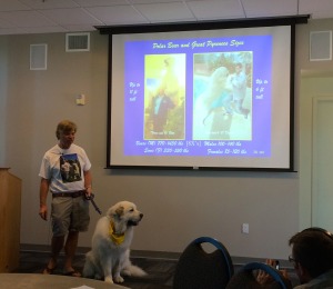
- Tommy Dickey (with Hot Rod Linkin), Professor and Secretary of the Navy/Chief of Naval Operations Chair in Ocean Sciences, Department of Geography – “Polar Bears and Great Pyrenees Dogs: A Matter of Scale!” How similar are Great Pyrenees dogs and polar bears? They are both large, white, and fluffy. They can both run at top speeds of around 25 to 30 mph (meaning they could keep up with world-record-setter Usain Bolt who tops out at about 27 mph). And they both rival otters and red pandas in their ability to participate in painfully adorable viral videos.
- Yingjie Hu, Ph.D. Candidate, Department of Geography – “Metadata Harmonization in Spatial Data Infrastructures”: How do you solve a problem like too much metadata? With smart technology, of course. Yingjie Hu has developed a learning machine program that is able to take an existing metadata classification system (such as the one used by Data.gov) in order to extrapolate and apply the same standards to other metadata imported into the system. This leads to better metadata harmonization in spatial data infrastructures. And when metadata is harmonized, everybody wins.
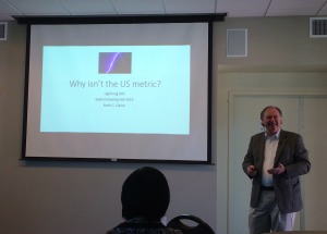
- Keith Clarke, Professor, Department of Geography – “Why is the U.S. not metric?”: The United States is one of three countries that is not metric-compliant (the two others are Myanmar and Liberia). However, Keith Clarke argues that the U.S. is in fact metric, we are just in denial about it. The metric system is used in science, education, manufacturing, and the military, and even our more common measurement units of feet and yards are defined in terms of their metric counterparts. Keith is currently working to re-establish the U.S. Metric Board to supervise a voluntary transition to the metric system.
Editor’s note: the samples above are limited to those by members of the Department of Geography; click here for the rest. Fourteen new and returning speakers made the fourth annual Lightning Talks a success. Geography graduate student Kitty Currier organized the event, which took place at Mosher Alumni House on February 25, 2015. Videos from all of the Spatial Lightning Talks will be posted to the website in the near future. Many thanks to Kitty for drawing our attention to this material.