The following is from the fall 2012 UCSB Library publication of “The Lens”:
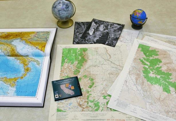
The Map & Imagery Laboratory (MIL) at UCSB Library is the largest imagery collection in any academic library in the country. The collections in MIL include a wide range of materials related to geospatial information, such as globes, maps, atlases, aerial photography, and digital remote sensing data.
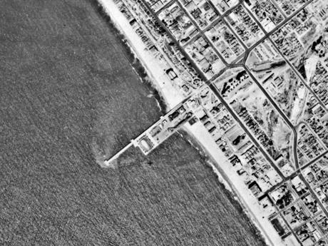
One of MIL’s highlights is an extensive compilation of California aerial photographs that date as far back as the 1920s. Most of these images are large-format photographs shot from fixed-wing aircraft by government agencies and their contractors, with a level of detail much higher than Google Maps. The same areas have been photographed every five years for almost ninety years, creating a uniquely valuable resource for researchers. This imagery is especially valuable for the study of urban change, environmental restoration, and disaster planning and is heavily used by academics and industry partners. MIL’s imagery collections also include topical sets such as World War II-era reconnaissance photographs of Japan, photographs taken of the earth and moon by Apollo astronauts, and images of Los Angeles after the 1992 riots.
Starting in the 1990s, MIL built some of the first online spatial search and delivery tools through grant-funded research projects, such as the National Geospatial Data Archive (NGDA) and the Alexandria Digital Library (ADL). MIL continues to invest in ADL, building new tools to make it easier for users to access collections that include airphotos of Central American rainforests and the locations of Santa Barbara storm drains.
MIL also has extensive holdings of printed maps that include topographic and geologic series of many different countries. These collections are most comprehensive from the 1950s through the 1980s and represent a unique portrait of the earth’s surface and subsurface before the invention of computer mapping. With the advent of geographic information systems (GIS), MIL now collects a whole new type of material and supports the appropriate tools for viewing and manipulating this data.
Once the exclusive domain of earth scientists, spatial data is now finding uses in various disciplines. Since historical maps and contemporary digital data can be easily combined using GIS, scholars in fields like history, literature, architecture, art and film and media are experimenting with what is being called the Spatial Humanities.
A Spatial Humanities project might trace the production of wine grapes and beer hops in 19th century America using the Newberry Library’s “Atlas of Historical County Boundaries” along with the U.S. “Census of Agriculture.” Or combine MIL’s historic aerial photographs with Google Earth to create a visualization of how the automobile forever changed the Southern California landscape. The UCSB Library is already using geo-tagging to allow vintage postcards and photos in our digital collections to be located on a map. Such remixing and representing of data is at the heart of an ongoing trend toward interdisciplinary and multimedia scholarship. MIL can help scholars identify appropriate data and use GIS software for all kinds of analysis. Last year, MIL head librarian Jon Jablonski joined scholars and artists in a daylong workshop called ‘Signal Traffic’ that investigated ways to visually represent the flow of information through the infrastructures associated with broadcast spectra, fiber-optic networks, and satellites. Jablonski provided the group with selections from MIL showing how this problem has traditionally been solved by cartographers mapping the flow of water through aqueducts, commodities flowing over rail and water transport networks, and the flow of human migration.
Google Maps and smart phones have brought basic maps into daily use for many people on campus. MIL offers researchers across campus the raw materials and technical expertise to take the next step in integrating spatial information into their work. If you are interested in using the Map & Imagery Laboratory for viewing, research, or teaching purposes, please contact Jon Jablonski, Head, Map & Imagery Laboratory at (805) 893-4049 or jonjab@library.ucsb.edu.