Since October 5 of this year, an online map application featuring spatial data of the UCSB campus created by members of the Department of Geography has been posted on the UCSB home page with the approval of Paul Desruisseaux, Associate Chancellor for Public Affairs. This powerful tool is a major asset for the campus and community, as well as a major kudo for Geography. The UCSB Interactive Campus Map (ICM) can be accessed via the A to Z index on the campus web site. You can find it under the letter “M” (Map – interactive campus map), and there is also an entry under the letter “I” for Interactive Campus Map; and, of course, there is a “quick link” on the home page of the Department of Geography’s web site.
Geography’s use of campus maps dates back to experiments with Reg Golledge’s Personal Guidance System. In recent years, campus data have been pulled together for use in various cartography and GIS classes, including field navigation with GPS. Keith Clarke started using the campus as a focus for Geography 176C projects in 2007, and, since then, various groups of students have proposed the idea of an online map of the UCSB campus, while some Ph.D. students, such as Julie Dillemuth, contributed via Campus-based dissertations. By early 2009, Dylan Parenti had constructed two, large-capacity, mid-range servers and was trained on ESRI’s ArcGIS Server software; the pieces were then in place for assembling the map.
“Shortly after seeing other online maps come into existence at other universities, I just wanted to have something for UCSB, however basic, available over the Web,” Dylan says. “Once the first dedicated ArcGIS Server machine was configured, I almost immediately spent my spare time editing a set of existing DCS (UCSB Design & Construction Services) coverages and rolled out the first online ICM prototype. Admittedly, it was ‘flat,’ but functional. At the time, I’d thought that I’d be able to invest more time to improve it gradually.” However, expanding the ICM had to be placed on a back-burner as Dylan began to take on more departmental computing responsibilities.
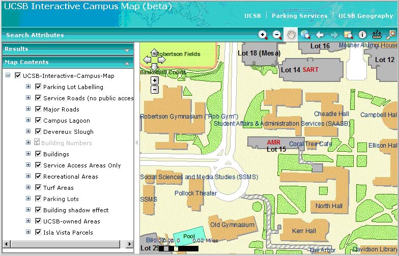
Graduate students Susan Tran and Alan Glennon became involved with the ICM this past summer when Dylan — now Geography’s IT Manager — asked them to work on ArcGIS Server administration and contribute to the map. According to Susan, “The original ICM was basically an automated web application that publishes a map document and makes it viewable online. It had very limited functionality and almost no search capabilities, so we decided to build a more powerful application in Javascript. Most of the functions in the new ICM were the result of us challenging ourselves and asking, ‘I wonder if we can make it do this or that.’ We wanted to create a map that improves that way we navigate, and, by late summer, we ended up with something that we hope will be really useful to our campus community.”
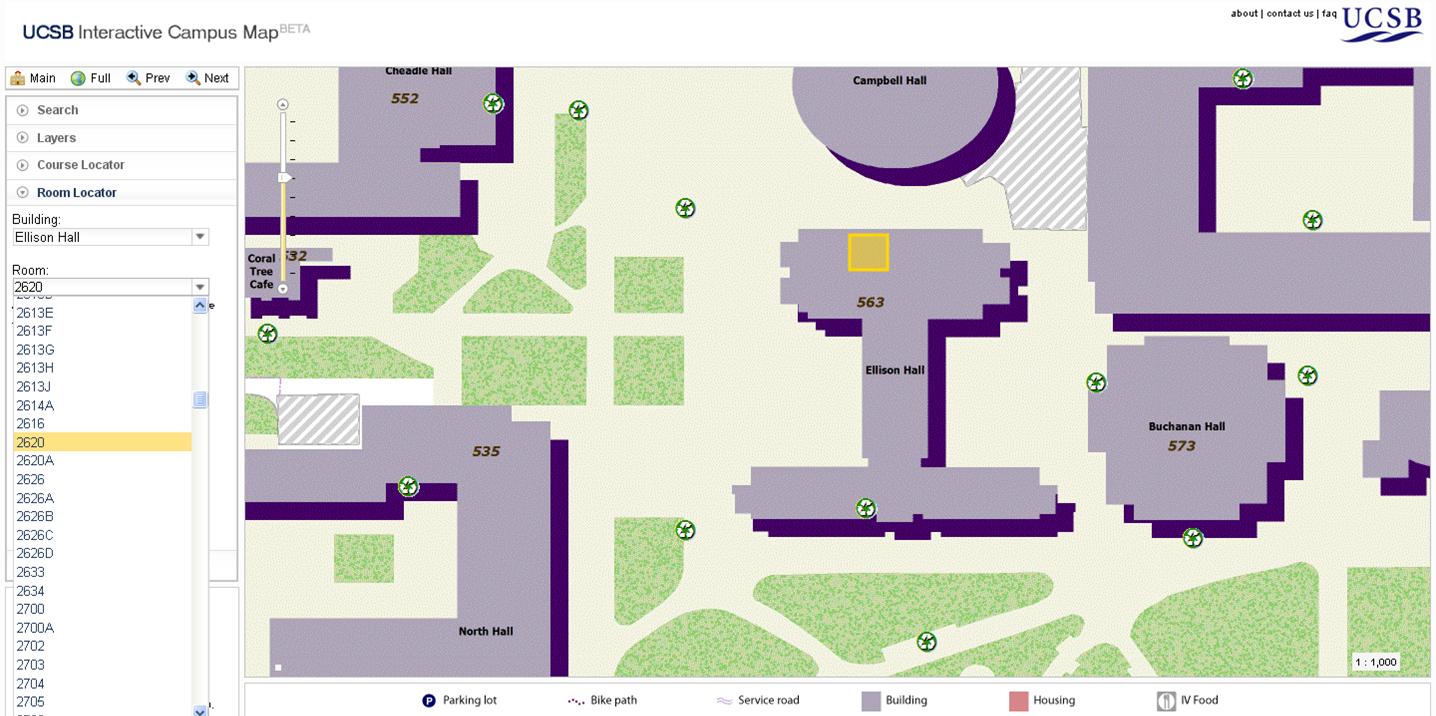
Susan points out that the ICM currently provides the ability to: 1) search for parking lots, recreation areas, or buildings by name, number, or registrar code; 2) locate a room inside a building for ~50 buildings on the main campus; 3) toggle layers of on-campus eateries, IV eateries, recycling bins, wireless network signal strength (mapped by Josh Bader), and parking lots by designation; 4) zoom to a classroom location with the course locator (currently only Geography Department classes are supported, but we hope to include the entire schedule of classes in the future); 5) get parking-lot specific information, such as number of spaces by permit type, upon clicking on a parking lot of interest; and 6) identify a feature on mouseover.
Susan and Alan are still working to improve the map, and the ICM team has recently been joined by a group of undergraduates who are helping them generate more important datasets. Possible future datasets to be created and added to ICM include:
- Accessibility elements: a) building door locations, b) elevators within buildings, c) outdoor stair locations (DCS), d) ramp locations
- Transportation elements: a) traffic light locations, b) MTD bus lines, c) airport
- Time aware layers: a) eateries with a time slider displaying “what’s open now,” b) campus resources (library hours, SAASB, student health center, etc)
- Details of UCen, SAASB, and Library floor plans
- Photo fly-outs of buildings
- Temporary construction zones


.jpg)

