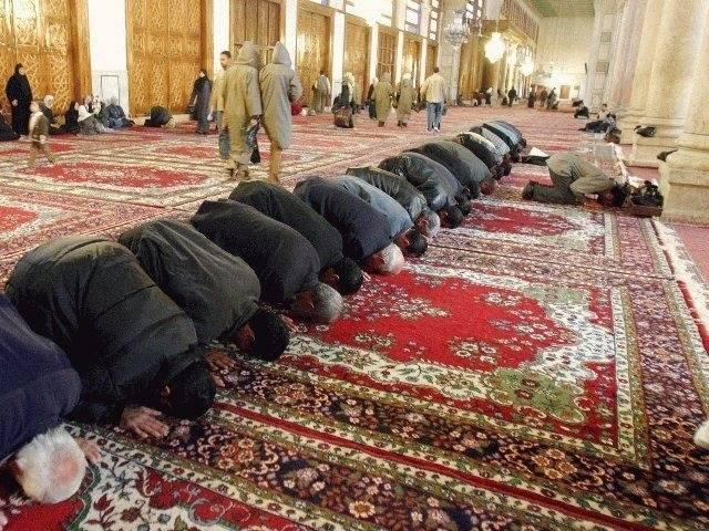
“From whencesoever Thou startest forth, turn Thy face in the direction of the sacred Mosque; that is indeed the truth from the Lord. And Allah is not unmindful of what ye do” (Qur’an 2:149–150).
Qibla (or qiblah; Arabic: قبلة) is an Arabic word for the direction that should be faced when a Muslim prays during Salah, the Islamic practice of formal prayer, usually performed five times a day. Since 622 AD, that direction has been towards Kaaba (The Cube), a cube-shaped building in Mecca, Saudi Arabia, which is the most sacred site in Islam. Muslim mosques are aligned with qibla, Muslims are buried with their faces in the direction of the qibla, and the fact that all Muslims pray towards the Kaaba is traditionally considered to be a symbol of the unity of all Muslims worldwide. (Wikipedia, Qibla).
But there are quibbles about qibla. A July 19 CNN article comments, “Indonesian Muslims have been praying in the wrong direction, the country’s highest Islamic authority has said. The Indonesian Ulema Council told the country’s Muslim populace in March to turn west when they offered their daily prayers. Muslims are supposed to face the Kaaba, the religion’s most sacred site in the city of Mecca in Saudi Arabia. At the time, the council said that the direction of Kaaba from Indonesia laid to the west. Turns out, it didn’t. Africa did. So, on Friday, the council issued a new edict: face northwest.”
Qibla has always been somewhat problematic. “The determination of the qibla has in the past exercised the minds of the greatest astronomers, geographers, and mathematicians of the Islamic world. Already in the late 8th century, sophisticated mathematical solutions were developed that were based on spherical trigonometry and the geographical knowledge of that period. The most commonly adopted algorithm was based on the great-circle path (or shortest-distance path) connecting the observer with the Ka‘ba in Mecca and determining its angle with the direction to North” (source).
“Several Muslim mathematicians and astronomers, such as Abu Rayhan Biruni, have discussed the correct way of determining the Qiblah direction from any point on the Earth’s surface. They agree that at the two moments in each year when the sun is directly overhead the Kaaba, the direction of shadows in any sunlit place will point directly away from the Qiblah. This happens on May 27 or May 28 at 9:18 GMT and on July 15 or July 16 at 9:27 GMT. Likewise there are two moments in each year when the Sun is directly over the antipodes of the Kaaba. This happens on January 12 or January 13 at 21:29 GMT and on November 28 at 21:09 GMT. Because the Earth is almost a sphere, this is almost the same as saying that the Qiblah from a place is the direction in which a bird would start flying in order to get to the Kaaba by the shortest possible way” (Wikipedia, Qibla).
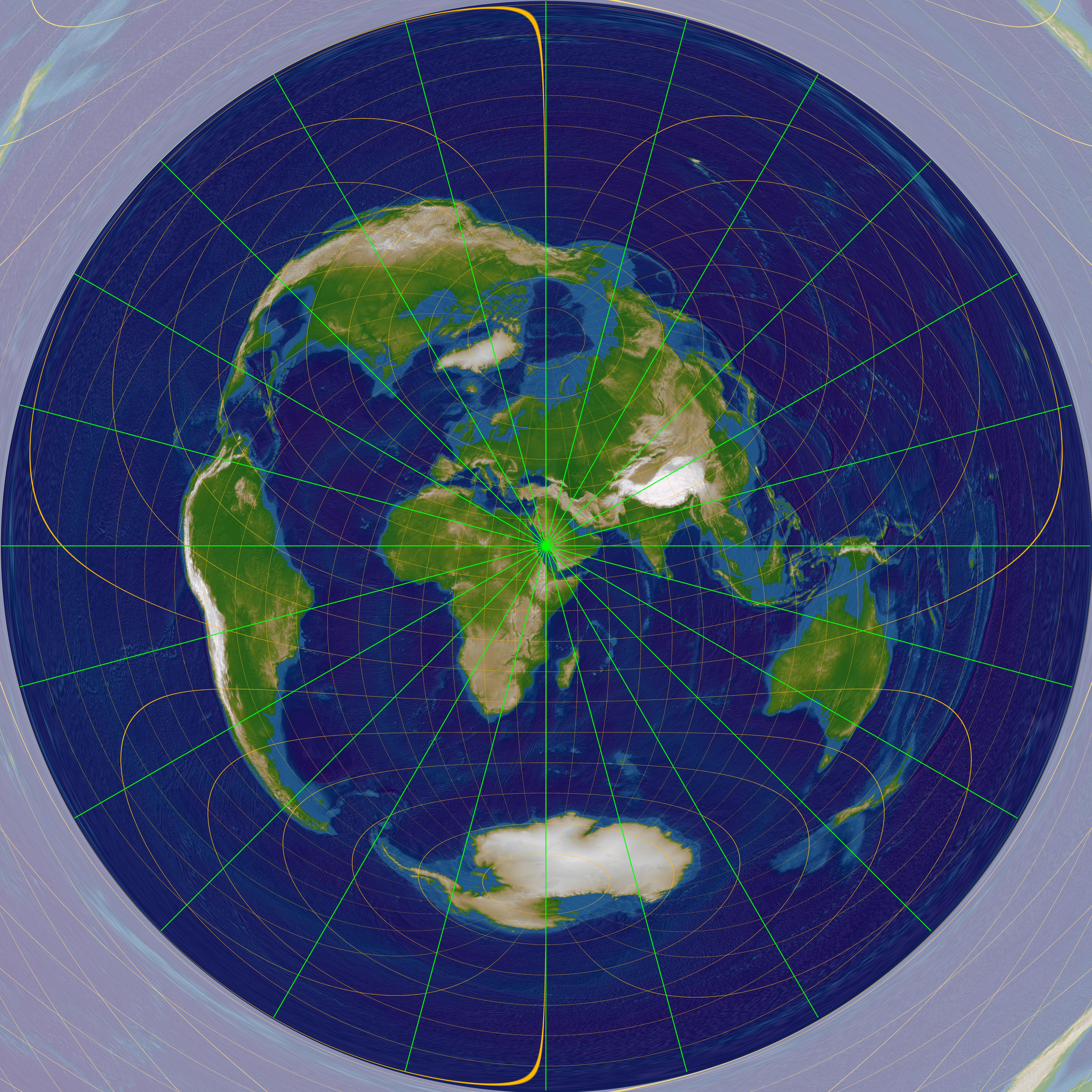
“The Craig retroazimuthal map projection was created by James Ireland Craig in 1909. It is a cylindrical projection preserving the direction from any place to another, predetermined place while avoiding some of the bizarre distortion of the Hammer retroazimuthal projection. It is sometimes known as the Mecca projection because Craig, who’d worked in Egypt as a cartographer, created it to help Muslims find their qibla. (source).
Today, there are several web sites devoted to finding qibla from any place on earth; for example, a web site called Earth Islamic claims to be “the first satellite-map based Qibla locator service and allows you to “find Qibla direction at any point on Earth accurately.” Debates about finding qibla from space (there have been several Muslim astronauts) resulted in a conference sponsored by the Malaysian National Space Agency in 2006 to address the issue; the conference concluded that the astronauts should determine the location of the qibala “according to [their] capability,” and the Grand Ayatollah Ali al-Sistani has stated that Muslim astronauts should face the direction of the Earth (Wikipedia, Qibla).
Editor’s note: Waldo Tobler published an excellent article on the subject in 2002 (W. Tobler, 2002, Qibla and Related Map Projections, Cartography and Geographical Information Systems, 29(1): 17-23): A PowerPoint presentation Waldo gave relating to the article can be found here.
Article by Bill Norrington


