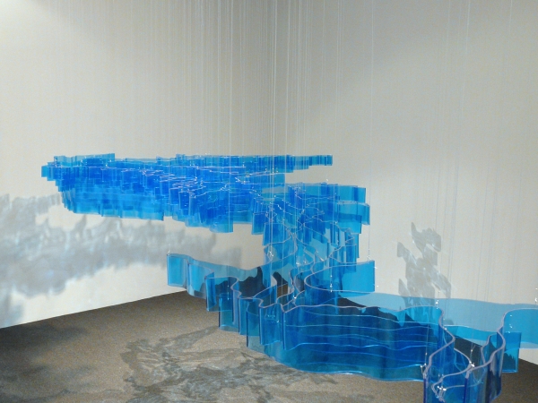
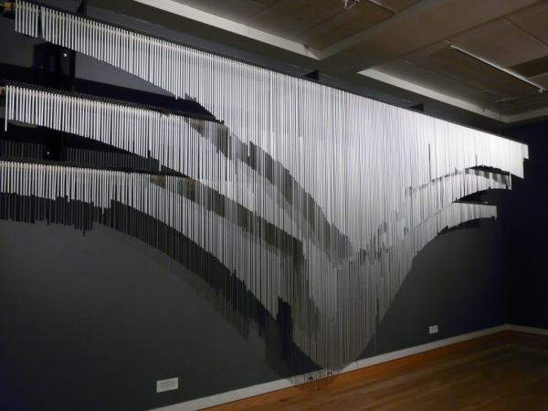
Stephen Cartwright is an artist and cyclist living in Urbana Illinois, currently teaching sculpture at the University of Illinois. Since 1999, he has recorded his exact latitude, longitude, and elevation every hour of every day, no mean feat insofar as he’s completed nearly 25,000 miles worth of bicycle journeys throughout North America, Asia, and Europe to date. Cartwright uses digital and traditional fabrication techniques to translate his collected data into his sculptural projects which focus on topography, particularly alteration of the landscape. (You can see more renderings of his latitude and longitude and associated art on his website.)
According to his blog, “About Me,” “For more than ten years, Stephen Cartwright has recorded his exact latitude, longitude and elevation every hour of every day. This data is embodied physically in his sculptural objects. While working in the exhibit industry, making displays and prototypes, Cartwright was introduced to the possibilities of digital fabrication, a technique he frequently uses in his current work. Cartwright was lured away from the exhibit industry to complete several grand bicycle journeys through North America, Europe, and Asia, totaling more than 20,000 miles. He relished the complete immersion in the landscape and culture that self-contained bicycle travel afforded. While Cartwright continues his work related to his latitude and longitude recordings, other recent work focuses on human alteration of the natural landscape. Cartwright earned a BA in Studio Art from the University of California, Davis and an MFA in Sculpture from Tyler School of Art. Cartwright is currently an assistant professor in sculpture at the University of Illinois at Urbana-Champaign and longs for the topographical relief that informs his practice.”
In a recent interview with The News-Gazette of Illinois, he was asked if all of his work dealt with topography: “A lot of it does and there’s a lot that doesn’t but still looks like it does. I’ve done a project where I mapped scabs healing on my body after a bike crash. It turned out to be a topographical study of my body. Now that I’m here in the flatlands, the geography and topography dictate where I go. I’m really interested in reservoirs and mines and other places where people make deep interventions into the landscape. I’m now starting to look at other things, like the weather, and how it influences what I do…I’ve always been curious about my place and this is just a sort of formalizing of my wanderlust. For me, big empty places on the map are places to be filled. The beauty of mountains, the intersections between water and land are all interesting.”