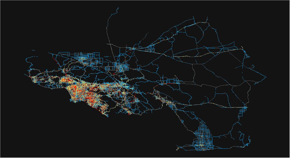
The GeoTrans laboratory in the UCSB Department of Geography developed, in partnership with University of Texas at Austin and Arizona State University, a state of the art transportation microsimulation model system called Simulator of Activities, Greenhouse (gas) Emissions, Networks, and Travel (SimAGENT) in Southern California. SimAGENT, using demographic, land use, and transportation data, simulates the life in a day of 18 million residents in the Southern California Association of Governments (SCAG) region. SCAG is the nation’s largest metropolitan planning organization, representing six counties (Imperial, Los Angeles, Orange, Riverside, San Bernardino, Ventura), 191 cities, and more than 18 million residents.
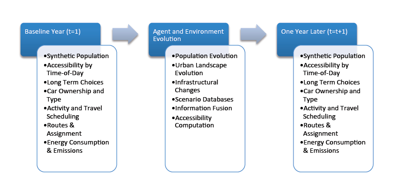
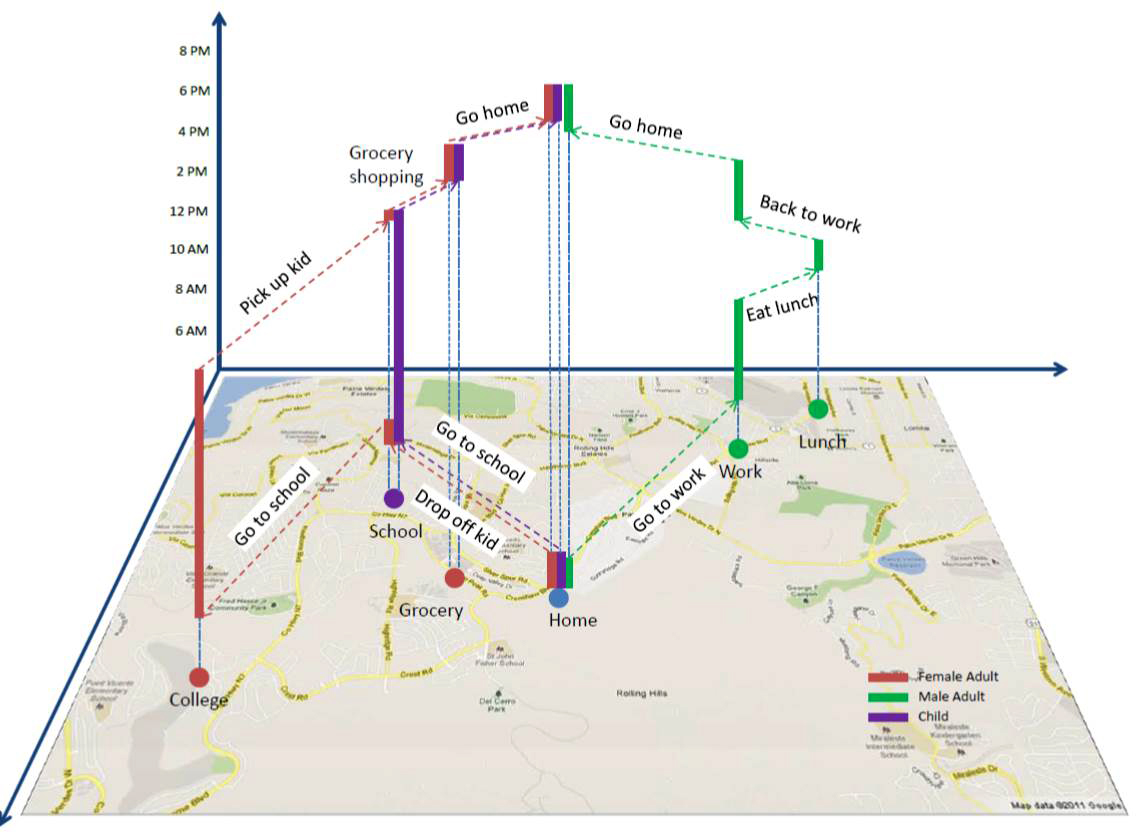
SimAGENT advantages in behavioral realism include but are not limited to: synthetic population generation that provides consistent data of persons and their households, scheduling of activities using allocation methods of tasks and cars within households, detailed car ownership and type to explore market penetration of electric cars and related technologies, use of land use sensitive accessibility indicators that account for the within-a-day dynamics of activity opportunities and transportation level of service, and a spatio-temporal multi scale model framework that can be used at any level of jurisdiction or geographic scale.
In this way, policies to curb Greenhouse gas (GHG) emissions for cars, trucks, and buses can be studied by running simulation scenarios and the optimal policy portfolio identified to meet desired targets of emission reduction by 2020 and 2035. The mission of the first version of SimAGENT, to demonstrate feasibility and deliver a prototype, was accomplished in the period of April 2009 to March 2013 (with a budget of approximately 2 million provided by SCAG, the Multicampus Research program Initiative on Sustainable Transportation, the University of California Transportation Center, and the UC Lab Fees program). Also, during this time, many graduate students and SCAG professionals were trained in advanced computational and econometric techniques while developing many of the components used to create SimAGENT.
The proof of maturity of a rapidly developed research product came early this year when SCAG announced at the Modeling Task Force meeting of January 30, 2013, that it will use this model system for its next cycle of developing a Regional Transportation Plan/Sustainable Communities Strategy (the planning document that guides the future of each region in California and the new strategies required by Senate Bill 375), and it issued a Request for Proposals, inviting consultant practitioners to bid on a project that uses the SimAGENT methods and recalibrates it with the data from the California Household Travel Survey that was completed in early 2013. Development of models for the next generation SimAGENT continues within a variety of other research programs at UCSB, ASU, and UT Austin, along with providing technical support to SCAG.
In this project, Kostas Goulias is the overall Principal Investigator, and the following post-docs and students worked more or less in this order of involvement: Dr. Yali Chen, Daimin Tang, Dr. Seo-Youn Yoon, Dr. Ting Lei, Srinath Ravulaparthy, Kate Deutsch, Pam Dalal, and Nate Isbell. At UT Austin, Professor Chandra Bhat is the PI, and Rajesh Paleti was the lead Ph.D. student investigator. At Arizona State University, Professor Ram Pendyala is the PI, and Karthik Konduri was the lead Ph.D. investigator. Additional information can be found at: http://www.scag.ca.gov/modeling/mtf/agendas/mtf013013agn.pdf, http://www.scag.ca.gov/modeling/, ; https://legacy.geog.ucsb.edu/geotrans/.
Editor’s note: Kudos to all concerned with this terrific project and many thanks to Professor Goulias for providing the material for this article.