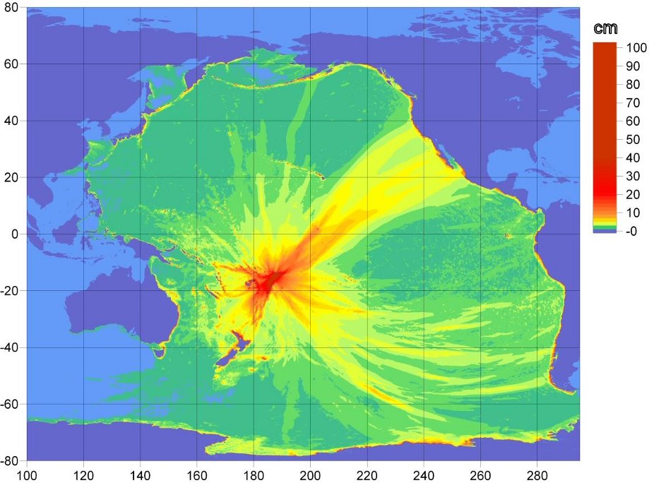
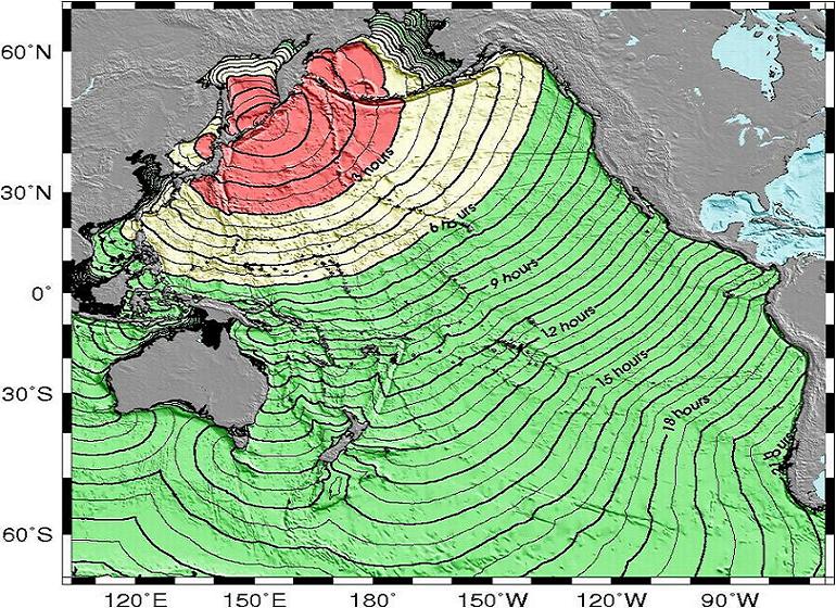
Thanks to the UCSB Alert system, the entire UCSB campus community received a tsunami advisory late this afternoon, September 29, 2009. The tsunami, caused by a magnitude 8.0+ temblor near Samoa, will have a minor impact on the Central Coast from the Monterey Bay sound to Point Conception in Santa Barbara County. While no local damage is expected, officials predicted that tides will rise 1 to 2 feet, arriving at Santa Barbara Harbor about 9:03 pm tonight.
The advisory was sent out by Associate Vice Chancellor Ron Cortez, Administrative Services, who pointed out that: “A tsunami advisory is in effect for the immediate coastal areas of Southern and Central California. This is not a tsunami warning or tsunami watch. Large inundations are not expected in areas under advisory status. However, minor wave fluctuations around one foot may be recorded in some areas of the coast which could produce dangerous currents and surges in harbors and bays. Coastal residents are advised to stay out of the waters, off the beach, and away from harbors and marinas. Wave height and currents are amplified by irregular shoreline and are difficult to predict. Minor wave fluctuations around one foot are expected to begin at 9:03 pm. These minor wave fluctuations could continue for several hours. The initial wave may not be the largest. The tsunami advisory is a result of the 8.0 earthquake that occurred at 10:48 AM near the Samoa Island region.”
The temblor generated three separate tsunami waves, the largest of which measured 5.1 feet from sea level, and the quake was recorded at about 6:48 a.m. at a depth of about 7.4 miles (11.9 km) off the Samoa Islands, according to the USGS. Early reports had the magnitude at 7.9, but the USGS upgraded that to 8.0 about two hours after the initial report. Dozens of people in the Samoan Islands are reported dead; further developments can be found at the National Oceanic and Atmospheric Administration (NOAA) website.
In 2004, NOAA recognized UCSB as the first college community in the nation to receive the dual recognition “TsunamiReady” and “StormReady.” Criteria for the former included the establishment of a 24-hour warning point and emergency operations center, the ability to have more than one way to receive tsunami warnings and to alert the public, willingness to promote public readiness through community education and the distribution of information, and the development of a formal tsunami plan, which includes holding emergency exercises. Ironically, a test of the emergency exercise was due this coming Friday. UCSB made it a moot point by proactively, prematurely, and expeditiously passing the test with flying colors.