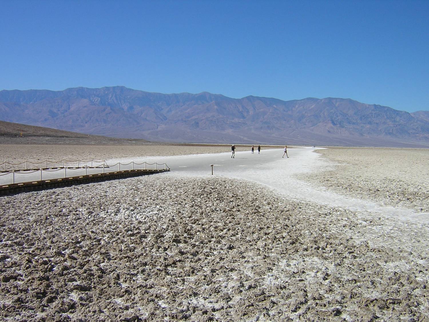
Professor Dan Montello returned safely from his recent field trip to Death Valley in the Mojave Desert of eastern California. To commemorate 50 years of life on Earth as he has known it, Dan and his assistant, M. V. Gray, explored the natural and human landscapes of the Valley from October 23 to 25, 2009. Death Valley is most known for its elevation, or lack thereof. At its lowest spot (Badwater Basin), it drops down to –282 feet (–86.0 meters) below sea level. This low basin was not created by river erosion but by the tectonic stretching of the elevated “blocks” to the east and west of the valley floor, and the consequent subsidence of the basin in between. Death Valley is part of the large Basin and Range Province that makes up virtually all of the state of Nevada and much of several other western states and northern Mexico (geographers enjoy the traditional German term “horst und graben” for the rising and falling blocks of the range and basin, respectively). In a bit of geo-irony, Mount Whitney (the highest spot in the conterminous U.S. at 14,494 feet or 4417.8 meters) is but 90 or so miles from Badwater, as the vulture flies.
Badwater Basin is the lowest exposed spot in North America, but it is not the lowest in the world, or even in the Americas. Honors for lowest spot go to a location in the Dead Sea in Jordan and Israel at –1,360 feet (–414.5 meters). In the Americas, Laguna del Carbón in Argentina bottoms out at –344 feet (–104.9 meters). In fact, Badwater Basin is only the eighth lowest exposed spot on Earth. The Salton Sea, nearby in Southern California, is itself –227 feet (–69.2 meters) elevation at its lowest.
Death Valley is also known as the hottest and driest place in North America. Elevation and climate are related, of course, and not only in the sense that lower places cause hotter climate, other things being equal. Climate also causes elevation, in a sense. Exposed low spots like Badwater Basin would be inundated by water if they were not in an arid climate. And Death Valley definitely provides aridity. For the last century, Death Valley has averaged 1.92 inches (4.88 centimeters) of precipitation per year (it has been getting wetter for a couple decades). The driest month of June has averaged a scant .04 inches (.10 centimeters), while even the wettest month of February has averaged only .35 inches (.89 centimeters). Death Valley is also very hot, which is common for arid places but not always the case. July is the hottest month in the Valley, on average, with daily highs a scorching 115° F (46° C) and daily lows still warm at 88° (31° C). But it gets considerably hotter in some years; the highest recorded temperature was 134° F (57° C) on July 10, 1913, a world record for nearly a decade. But most of us can cope with a temporary heat wave; it’s the constant heat that really stretches our psychological coping abilities to their limit. In 1917, 43 consecutive summer days passed in Death Valley with daily highs of 120° F or above. Ouch. (Note: The hottest average summer on record occurred recently, in 1996.)
The hot and dry climate of Death Valley derives from several geographic factors. It’s latitude of around 36°N is near the high-pressure boundary between the Hadley and Ferrell cells, commonly associated with the locations of much of the world’s desert areas. Death Valley’s elevation leads to heat, for the usual reason that lower elevations have higher air pressures, but also because the high mountain “walls” around the valley trap heat. The dry air of the valley is clear, which allows a great amount of sunlight to reach and heat up the sparsely vegetated ground surface (which can be more than 50° F hotter than the air temperature!). Finally, the several mountain ranges between the Pacific Ocean and Death Valley suck most of the moisture out of the atmosphere as it moves west to east (orographic precipitation at high elevations), creating a serious “rain shadow” in Death Valley.
Death Valley has some fascinating physical geography, but its human geography is interesting, too. Around 50 or 60 descendants of the Timbisha Shoshone Indians still live in the Valley. Their ancestors came to the area more than a thousand years ago. As one would expect, the activity patterns of the Shoshone were exquisitely adapted to seasonal patterns in the harsh climate. They lived off springs, several of the hundreds of plant species (pinyon pine nuts and mesquite beans were major foods), and wildlife such as lizards, rabbits, and bighorn sheep.
The beginning of the end of the traditional Shoshone life style, and the source of the name “Death Valley,” came from the infamous journey of a group of “49ers” headed to the California gold fields in 1849-1850. Winter was not the time to take the usual route west across the high Sierra Nevada range to Sutter’s Mill (as the Donner party found out). Instead, the 49ers took a southerly route along the Old Spanish Trail, which wound its way south of the Sierras. A subset of this original party entered what is now known as Death Valley while following a shortcut that had been on a map sketched by John Fremont on an earlier exploration; however, the person with the map deserted them along the way. Although the going was tough, it was December, so the weather in Death Valley was actually some of the best they encountered on their trip. Nonetheless, the landscape was harsh and dry, and the party was disoriented and uncertain. The party members probably assumed they would never leave alive. As they finally departed to head west over the Panamint Mountains, the story goes that one man turned back to bid “goodbye, Death Valley.” The name stuck. Ironically, it appears that only one member of the party actually died in the Valley, and that may have been from a residual condition he brought with him into the Valley. Since the events that led to its name, however, Death Valley has been the site of more than a few human deaths. Just since the time Professor Montello returned from his field trip a couple weeks ago, a news story reported that remains were found of four German tourists who disappeared during a vacation trip 13 years ago.
Of course, mining has also attracted people to Death Valley and not just through it. Undoubtedly, the mining of borax has been the most famous mining activity in Death Valley. Borax was long known as a key component in laundry detergents, but in fact, it is today used in a variety of products such as fiberglass and fire-resistant materials. One of the first borax operations was the Harmony Borax Works, active from 1883 to 1888. Its most famous claim to fame was its Twenty Mule Team wagon used to transport the borax. The striking image of the team and wagon was used for the company’s advertising campaign; this got real airplay when it became part of the Death Valley Days radio and television programs. Besides borax, prospectors have attempted to extract many other minerals from Death Valley, including gold, silver, antimony, copper, lead, zinc, talc, and tungsten. Both strip and open-pit mining have been practiced. But mining operations generally declined throughout much of the 20th century, and the last active operation ceased in 2005 with the closing of the Billie Mine, an underground borax mine. One can visit some of the ghost towns and abandoned mines that remind us of yet another aspect of human-environment relations in Death Valley’s history.
Reference: Web site of Death Valley National Park

