“A pole of inaccessibility marks a location that is the most challenging to reach owing to its remoteness from geographical features that could provide access. Often it refers to the most distant point from the coastline. The term describes a geographic construct, not an actual physical phenomenon. Subject to varying definitions, it is of interest mostly to explorers” (source).
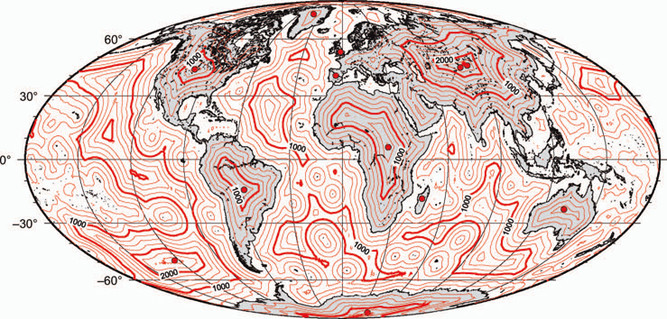
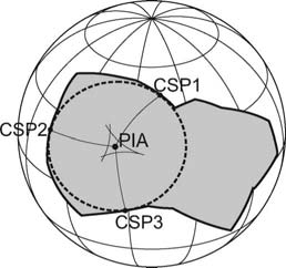
Poles of inaccessibility are generally referred to as continental or oceanic. In terms of continental inaccessibility, “distance from the sea is historically related to isolation and inaccessibility. A [Continental] Pole of Inaccessibility (PIA) is defined as the location furthest from a particular coastline. The concept was first introduced by Vilhjalmur Stefansson (1920) to distinguish between the North Pole and the most difficult-to-reach place in the Arctic [the Northern Pole of Inaccessibility]. Thereafter, it has been widely used to refer to the place in Antarctica furthest from the sea [the Southern Pole of Inaccessibility]. This exploration challenge was first achieved in 1958 by the 2nd Soviet Antarctic Expedition led by Aleksei Treshnikov. The term is also used to refer to the place on Earth that is furthest from any ocean (Eurasian Pole of Inaccessibility, located in central Asia (Garcia-Castellanos, D.; U. Lombardo [2007]. “Poles of Inaccessibility: A Calculation Algorithm for the Remotest Places on Earth”. Scottish Geographical Journal 123 (3): 227–233. doi:10.1080/14702540801897809).
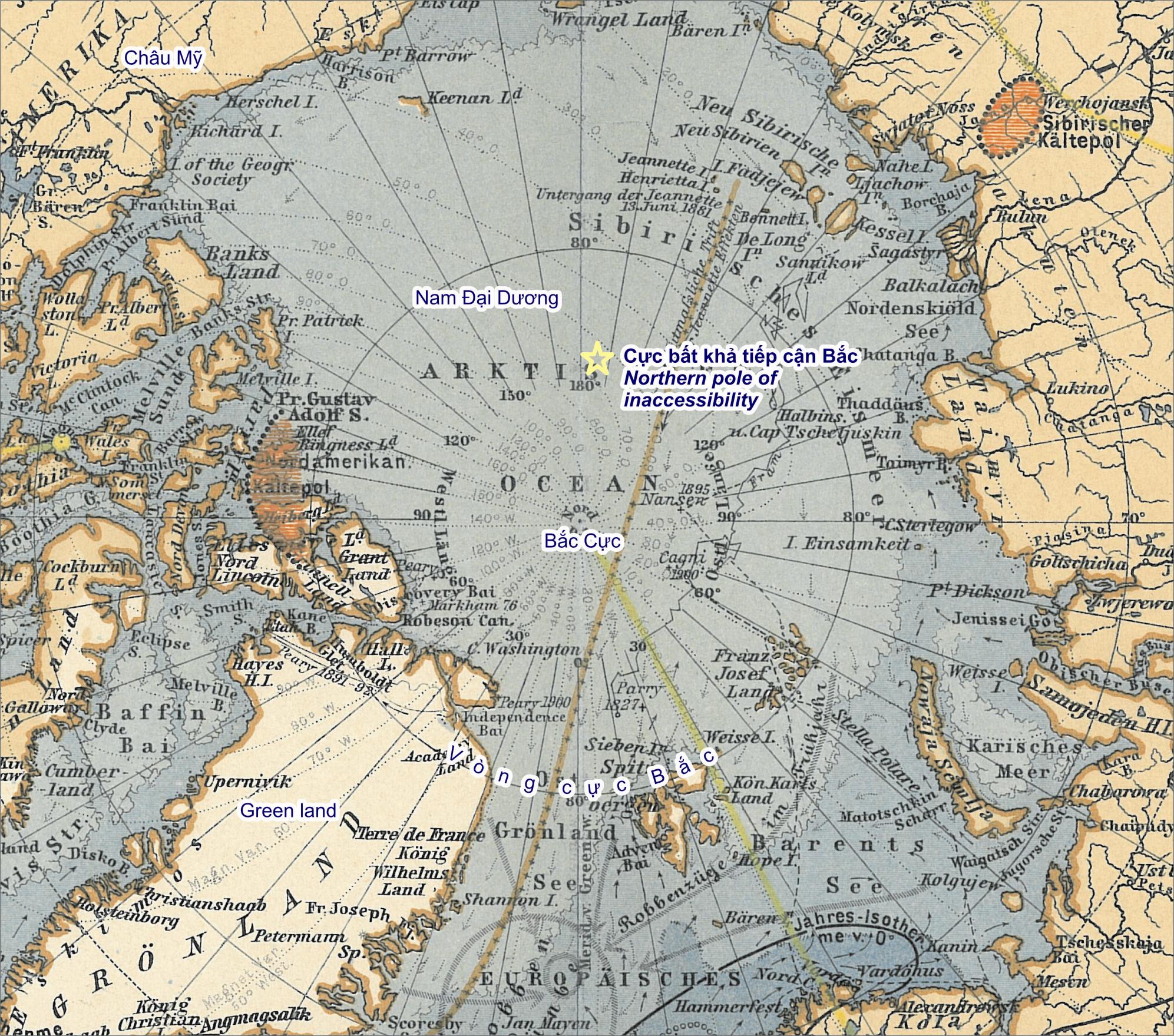
The northern pole of inaccessibility (84°03′N 174°51′W), sometimes known as the Arctic pole of inaccessibility, or just Arctic pole, is located on the Arctic Ocean pack ice at a distance farthest from any land mass. It is 661 km (411 statute miles) from the North Pole, 1,453 km (903 mi) north of Barrow, Alaska, and equidistant from the three closest landmasses, Ellesmere Island, Franz-Josef Land, and the New Siberian Islands, 1,094 km (680 mi) away. It was first crossed by Sir Hubert Wilkins, who flew by aircraft in 1927; in 1958, a Russian icebreaker reached this point. Owing to the constant motion of the pack ice, no permanent structure can exist at the pole (source).
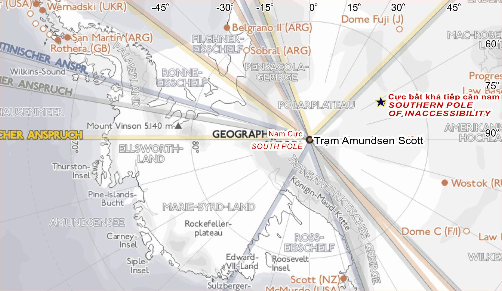
The southern pole of inaccessibility is the point on the Antarctic continent most distant from the Southern Ocean. A variety of coordinate locations have been given for this pole. The discrepancies are due to the question of whether the “coast” is measured to the grounding line or to the edges of ice shelves, the difficulty of determining the location of the “solid” coastline, the movement of ice sheets and improvements in the accuracy of survey data over the years, as well as possible typographical errors. The pole of inaccessibility commonly refers to the site of the Soviet Union research station which lies at 82°06′S 54°58′E (though some sources give 83°06′S 54°58′E). This lies 878 km (545 statute miles) from the South Pole, at an elevation of 3,718 m (12,198 ft). Using different criteria, the Scott Polar Research Institute locates the pole at 85°50′S 65°47′E. According to ThePoles.com, the point farthest from the sea accounting only for the Antarctic land surface proper is at 82°53′14″S 55°4′30″E, and the farthest point when ice sheets are taken into account is 83°50′37″S 65°43′30″E. These points, calculated by the British Antarctic Survey, are quoted as being “the most accurate measure available” (as of 2005) (Ibid.).
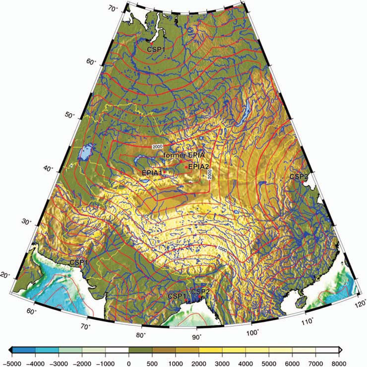
In Eurasia, the Continental Pole of Inaccessibility (46°17′N 86°40′E) is the place on land that is farthest from the ocean, and it lies in north-western China, near the Kazakhstan border. Earlier calculations suggested that it is 2,645 km (1,644 mi) from the nearest coastline, located approximately 320 km (200 mi) north of the city of Ürümqi, in the Xinjiang Autonomous Region of China, in the Dzoosotoyn Elisen Desert. The nearest settlements to this location are Hoxtolgay at 46°34′N 85°58′E, about 50 km (31 mi) to the northwest, Xazgat at 46°20′N 86°22′E about 20 km (12 mi) to the west, and Suluk at 46°15′N 86°50′E about 10 km (6.2 mi) to the east. However, the previous pole location disregards the Gulf of Ob as part of the oceans, and a recent study (D. Garcia-Castellanos & U. Lombardo, 2007) proposes two other locations as the ones farther from any ocean (within the uncertainty of coastline definition): EPIA1 44.29°N 82.19°E and EPIA2 45.28°N 88.14°E, located respectively at 2510±10 km and 2514±7 km from the oceans. Coincidentally, the continental and oceanic poles of inaccessibility have a similar radius; the Eurasian poles EPIA1 and EPIA2 are ~178 km closer to the ocean than the oceanic pole is to land (Ibid.).
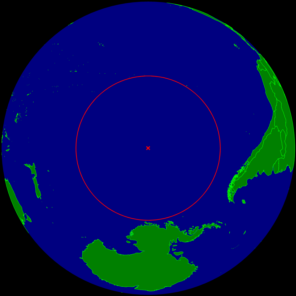
The oceanic pole of inaccessibility (48°52.6′S 123°23.6′W) is the place in the ocean that is farthest from land. It lies in the South Pacific Ocean, 2,688 kilometres (1,670 mi) from the nearest lands: Ducie Island (part of the Pitcairn Islands) in the north, Motu Nui (part of the Easter Islands) in the northeast, and Maher Island (near the larger Siple Island, off the coast of Marie Byrd Land, Antarctica) in the south. Chatham Island lies farther west, and Southern Chile in the east. This location is also referred to as “Point Nemo”, a reference to Jules Verne’s Captain Nemo. The term is also used occasionally in the Northern Hemisphere in conjunction with a point in the Arctic Ocean that is equidistant from the encircling landmasses; it lies 400 miles (640 km) from the North Pole in the direction of Alaska (Ibid.).
In North America, the continental pole of inaccessibility is in southwest South Dakota about eleven miles southeast of the town of Kyle, located 1,650 km (1,030 mi) from the nearest coastline at 43.36°N 101.97°W. In the UCSB Department of Geography, the pole of inaccessibility is 1841 Ellison Hall (just teasing our extremely busy Executive Officer, Mo Lovegreen).
Editor’s note: Many thanks to Stella Larson for suggesting this material.