The following is a National Oceanic and Atmospheric Administration article titled “NOAA satellites – helping save lives for 30 years,” dated October 9, 2012:
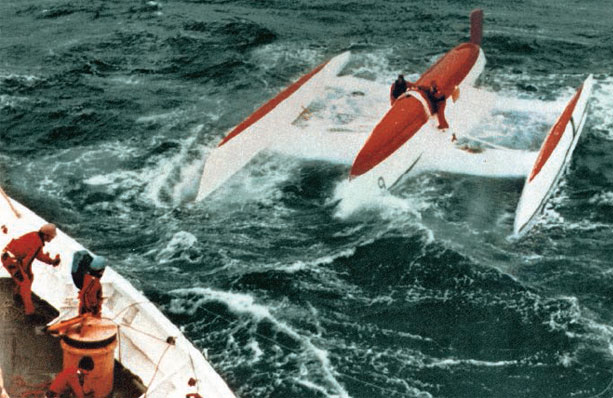
Thirty years ago, about 300 miles off the coast of New England, a barrage of towering, 25-foot waves battered a catamaran sailboat, causing it to begin sinking. A satellite, orbiting in space, detected the signal from an emergency beacon onboard the boat. A short while later, a U.S. Coast Guard cutter pulled the three passengers to safety.
The Search and Rescue Satellite-Aided Tracking system, or Cospas-SARSAT, is celebrating the 30th anniversary of this first life-saving rescue in the United States, which occurred October 10, 1982. NOAA operates several satellites and the U.S. Mission Control Center as part of the international program that has been responsible for the rescue of more than 30,000 people worldwide and nearly 7,000 in the United States since its inception in 1982.
Cospas-SARSAT began as an effort between the United States, Canada, France and the former Soviet Union to establish a network of satellites, equipped with technology to detect and locate distress signals from emergency beacons onboard aircraft and ships, and later on from handheld personal locator beacons. “Before SARSAT, there was no system to quickly find people who were in trouble whether they were sailing, went down in a plane crash, or if they were stranded in a remote area on a hiking trip,” said Chris O’Connors, NOAA SARSAT program manager. “Time after time NOAA satellites have made the difference between life and death thanks to this international program.”
Today, 43 countries and organizations around the world participate in the operation and management of the Cospas-SARSAT program, which includes a total of 12 satellites. SARSAT is a sophisticated satellite-to-ground relay system. When a satellite pinpoints a distress signal within the United States, or its surrounding waters, the information is relayed to the U.S. SARSAT Mission Control Center located at NOAA’s Satellite Operations Facility in Suitland, Md. The information is then sent to a Rescue Coordination Center, operated by either the U.S. Air Force, for land rescues, or the U.S. Coast Guard, for maritime rescues.
One of the more notable SARSAT rescues during the past 30 years, include the rescue of Abby Sunderland in June 2010. Then 16-years old, Sunderland attempted a solo voyage around the world by boat, but ran into high winds and rough seas in the Indian Ocean. Her distress signal was first detected by an Indian satellite, and then located by a NOAA satellite; the signal was relayed by ground stations in India and Pakistan, and finally saved by Australian and French rescuers. An interactive map with details of each of the 198 rescues that have happened in the United States so far in 2012 can be found online. Cmdr. Mark Turner, with the U.S. Coast Guard’s Office of Search and Rescue, said, “Every minute counts when a life is in jeopardy. With the teamwork of NOAA and the U.S. search and rescue agencies, the SARSAT system does what it was intended to do – save lives.”
In the United States, all emergency beacon owners are required by law to register their devices with NOAA. Through the end of August 2012, more than 350,000 emergency beacons were registered with the agency. In the future, Cospas- SARSAT will transition to instruments mounted on the Global Navigation Satellite System (GNSS) composed of new generation global positioning satellites from the United States, Russia, and European Union. There will be a total of 72 satellites in a medium-Earth orbit, which will allow for even greater and more accurate satellite coverage than today’s SARSAT system. The future system is still in the development stage and should begin limited operations in 2015. Allan Knox, manager of the USAF Search and Rescue/GPS program said, “The U.S. Air Force has relied upon SARSAT to help us locate distressed aviators and outdoorsmen throughout the U.S. and the world. And we are extremely excited about this future transition with advanced technology in space and the promising capabilities of the second generation of beacons.”


