The following is an article by Yale University’s Environment 360 Digest (a publication of the Yale School of Forestry & Environmental Studies), posted 23 January with the title above:
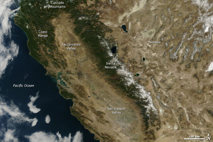
A pair of NASA images, taken a year apart, show the profound impacts of California’s current drought, which Gov. Jerry Brown said yesterday poses a major threat to California’s environment and economy. A satellite image taken last Saturday shows virtually no snow cover in the Coast Range and Cascade Mountains, and only a modest amount of snow in the Sierra Nevada. Officials say the snowpack is only 10 to 30 percent of normal levels. In addition, California’s vital agricultural areas in the Sacramento and San Joaquin valleys, which lie west of the Sierra Nevada, are a parched brown.
By contrast, a satellite image taken in January 2013 shows significant snowpack in the mountains and a swath of green in the Sacramento and San Joaquin Valleys. In his State of the State address, Brown did not specifically blame the drought — the worst in the state’s 163-year history — on climate change. But he said the current situation is “a stark warning of things to come” and that the state can expect higher temperatures, lower snowpack, and more extreme weather events in the future. Half of California’s yearly precipitation falls between December and February, so January’s record dry conditions threaten water supplies for the entire year.
Editor’s note: Many thanks to Professor Charles Jones for recommending this article.