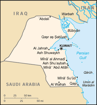
Kuwait is a constitutional emirate with a parliamentary system of government. Kuwait City serves as the country’s political and economic capital. The country has the world’s fifth largest oil reserves, and petroleum products now account for nearly 95% of export revenues and 80% of government income. Kuwait is the eleventh richest country in the world per capita and, in 2007, had the highest human development index in the Arab world. Kuwait is classified as a high income economy by the World Bank and is designated as a major non-NATO ally of the United States. Kuwait has the highest literacy rate among the Arab world with 94%, up from 93.3% in 2005 (Wikipedia: Kuwait)
“Seen at night, Kuwait City contrasts dramatically with the dark surface of the Persian Gulf and the sparsely populated desert. Night views also show some aspects of urban geography that are difficult to perceive in daylight images. Here the focus of radial traffic arteries and “ring roads” guide the eye toward the financial center of Kuwait’s capital—on the cape extending into Kuwait Bay, north of the First Ring Road. The numbering of the ring roads shows the progressive southward development of the city towards the Seventh Ring Road, which still lies outside the built-up area.
The differences in the color of city lighting also provide information on the urban geography. Areas with lighting of a yellow-green tinge are newer residential districts. The town of Al Ahmadi, known for its verdant vegetation, was built in 1946 when oil was discovered; it stands out with a characteristic blue-white light. Kuwait International Airport, like most major airports around the world, is particularly bright due to the high concentration of lights. By contrast, the low residential density of the Emir’s palace grounds—which also host Kuwaiti government offices and a large mosque—stand out as a dark area within the city. The long, dark zone facing the Persian Gulf coast, just inshore of a narrow zone of coastal villas (image right), is being prepared for residential construction” (source: NASA Earth Observatory).


