Waldo Tobler doesn’t like being called a “living legend,” but, in the world of Geography, he’s just that. You know who I mean—the “elderly” gentleman with the huge smile and thinning head of hair who likes to wear shorts and sandals and always attends Geography functions with his gracious wife Rachel; “that old guy” who spends a fair amount of time in the Geography Department’s copy room, printing out graphics of arcane map projections for his latest publications and muttering about the inadequacy of modern gadgets (btw, Waldo was the first person in the entire Department to have had a personal computer); and, as it so happens, one of two UCSB geographers to have a Wikipedia page devoted to them (the other being Professor Emeritus Mike Goodchild). Here’s Wikipedia’s tribute to Waldo:
Waldo Tobler (born 1930) is an American-Swiss geographer and cartographer. Tobler’s idea that “Everything is related to everything else, but near things are more related to each other” is referred to as the “first law of geography.” Tobler is a Professor Emeritus at the University of California, Santa Barbara Department of Geography.
In 1961, Tobler received his Ph.D. in geography from the University of Washington at Seattle. At Washington, he participated in geography’s William Garrison-led quantitative revolution of the late 1950s. After graduating, Tobler spent several years at the University of Michigan. Until his retirement he held the positions of Professor of Geography and Professor of Statistics at the University of California, Santa Barbara. The University of Zurich, Switzerland, awarded him an honorary doctorate in 1988.
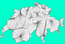
Tobler was one of the principal investigators and a senior scientist in the National Science Foundation-sponsored National Center for Geographic Information and Analysis. He has used computers in geographic research since the 1960s, with emphasis on mathematical modeling and graphic interpretations. Well known for his publications, he formulated the “first law of geography” in 1970 while producing a computer movie, and is the inventor of novel and unusual map projections, among which was the first derivation of the partial differential equations for area cartograms. He also invented a method for smooth two-dimensional mass-preserving areal data redistribution. In 1989, the American Geographical Society awarded Tobler with the Osborn Maitland Miller Medal.
Tobler has been involved recently in building a global, latitude-longitude oriented, demographic information base with resolution two orders of magnitude better than was previously available. He also had been examining the development of smooth finite element and categorical pycnophylactic geographic information reallocation models. In July 1999 he presented a keynote speech, “The World is Shriveling as it Shrinks,” at the ESRI International User Conference, and was the recipient of a Lifetime Achievement Award in GIS by ESRI. Taylor and Francis of London recently published a map projection book, co-authored with Q. Yang of China and the late John P. Snyder. Current interests relate to ideas in computational geography, including the analysis of geographical vector fields and the development of migration and of global trade models.
Tobler has also been concerned with the representing flow (due to its involvement with movement as a mechanism of geographic change). In 2003, Tobler released a freeware, Microsoft Windows-based version of his flow representation software Flow Mapper. In 2005, an ESRI ArcGIS version of the software, inspired by Tobler, was developed by John Alan Glennon and Michael Frank Goodchild at UCSB. Both versions are available from the Center for Spatially Integrated Social Science.
Tobler’s many honors include Member of the National Academy of Sciences of the United States; Honorary Fellow, American Geographical Society; Osborn Maitland Miller Medal, American Geographical Society 1989; Meritorious Contributor Medallion, Association of American Geographers, 1971; Andrew McNally Award, 1986; ESRI Lifetime Achievement Award, 1999; AAG Microcomputer Specialty Award, 1993; Phi Beta Kappa, Sigma Xi, Phi Kappa Phi. Tobler served on the National Research Council the Board on Earth Sciences; he has been on the editorial board of several journals, including The American Cartographer, Journal of Regional Science, Geographical Analysis, and the International Journal of Geographical Information Systems; and he was a charter member of the Urban and Regional Information Systems Association, a council member of the Regional Science Association, member and chairman of the Mathematical Social Science Board, and served as the United States delegate to the International Geographical Union Commission on Geographical Data Processing and Sensing. Until his retirement, he was a member of the Royal Geographical Society of Great Britain (source).
No, you don’t have to bow in Waldo’s presence. But he’d be tickled if you knew who he was, knew a bit about his major contributions to the discipline, and, more importantly, understood any of them. (And don’t call him “that old guy”!)
.jpg)