Geography graduate student Kitty Currier wrote the following description of her attempt to supplement her SCUBA-based observations of reefs and fish populations by using kite aerial photography (KAP) as a relatively inexpensive means of generating high-resolution aerial imagery for her marine research:
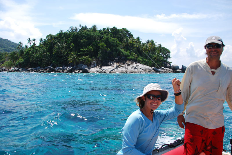
I’ll be the first to admit that there are worse things than six weeks of fieldwork in the South China Sea. If the work happens to involve flying a kite over white sand beaches and SCUBA diving on coral reefs, so much the better. Such a trip comprised a large part of my summer in the Anambas Islands, Indonesia, with volunteers of the Biosphere Foundation, a non-profit organization promoting marine conservation initiatives in Anambas and elsewhere.
Based onboard the 34-meter SY Mir, we moored off the tiny (less than one square kilometer) island of Durai. This hilly speck of land provides refuge for passing fishermen as well as hundreds of nesting green and hawksbill turtles every year, according to Pak Lahanie, a spry 80-something-year-old who makes up about a quarter of Durai’s permanent human population.
The main purpose of our visit was to assess the condition of the reefs and fish populations around Durai. Through underwater surveys, we catalogued fish species and coral genera, noted the presence of disease and other damage on coral colonies, and classified reef morphology at different sites around the island.
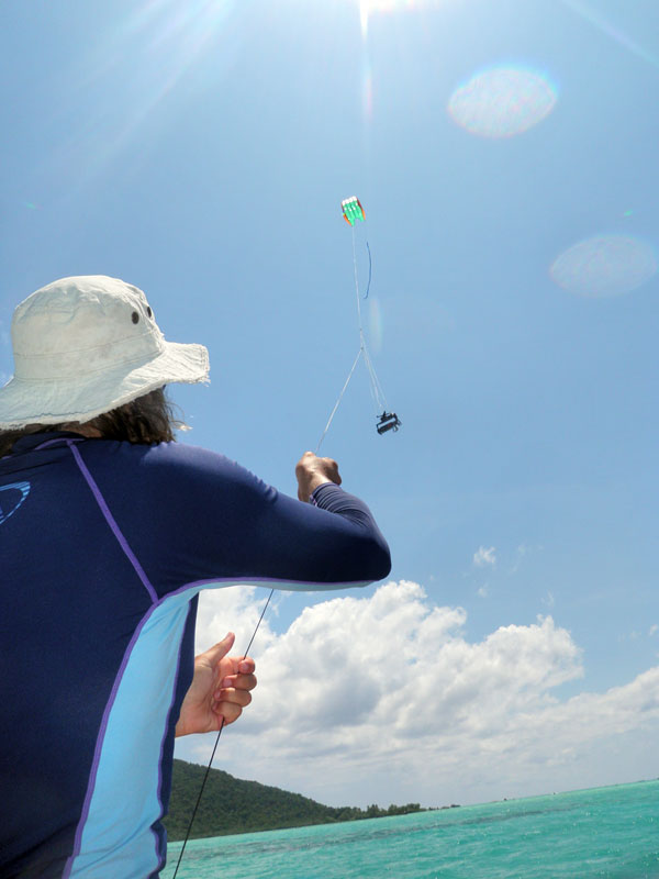
To complement the underwater observations, we collected aerial photographs of Durai’s coastlines and shallow reefs using a camera suspended from the line of an airborne kite. Shooting coastlines was a three-person affair: one drove the dinghy, one held the kite line, and one helped with kite launches and landings, the trickiest parts of the operation. In preparation for georeferencing the images, we walked along beaches and scrambled over rocky coasts, collecting ground control points with a handheld GPS receiver.
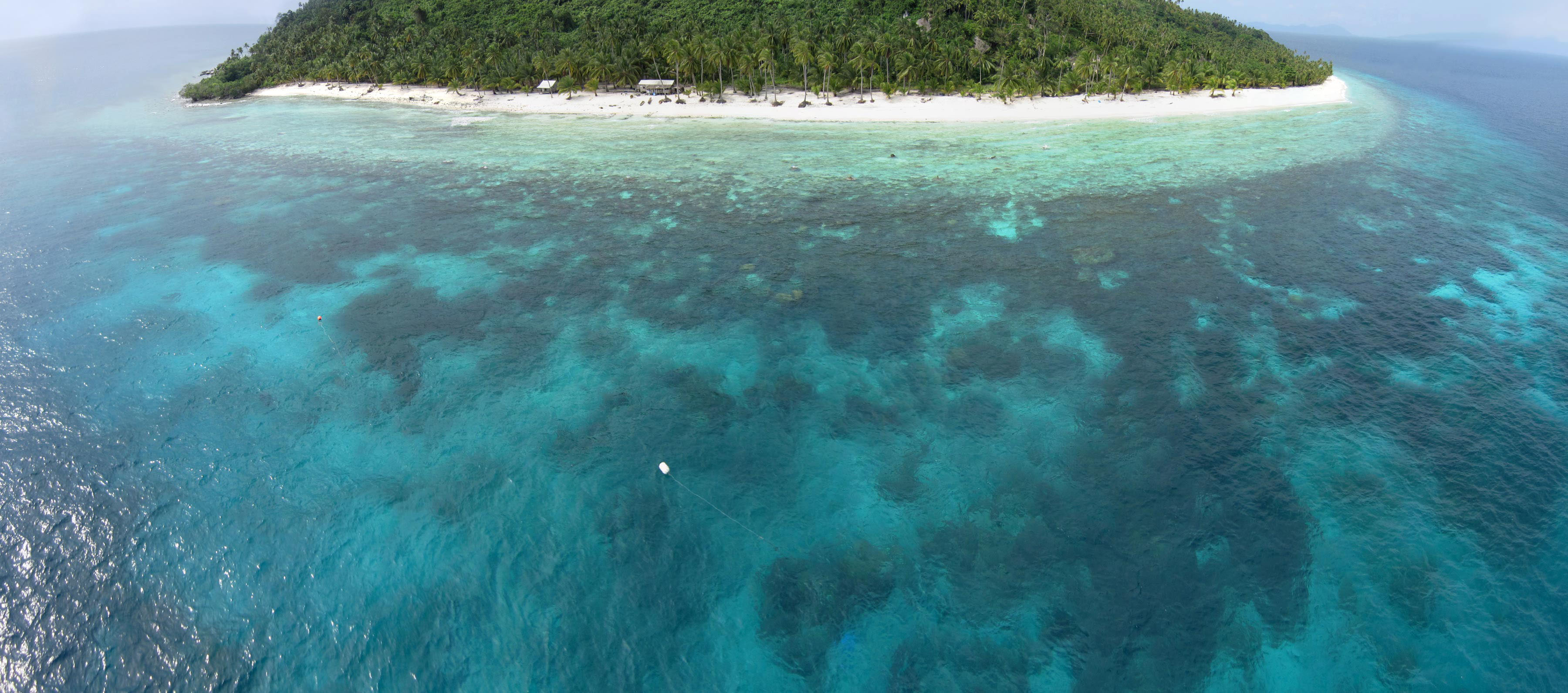
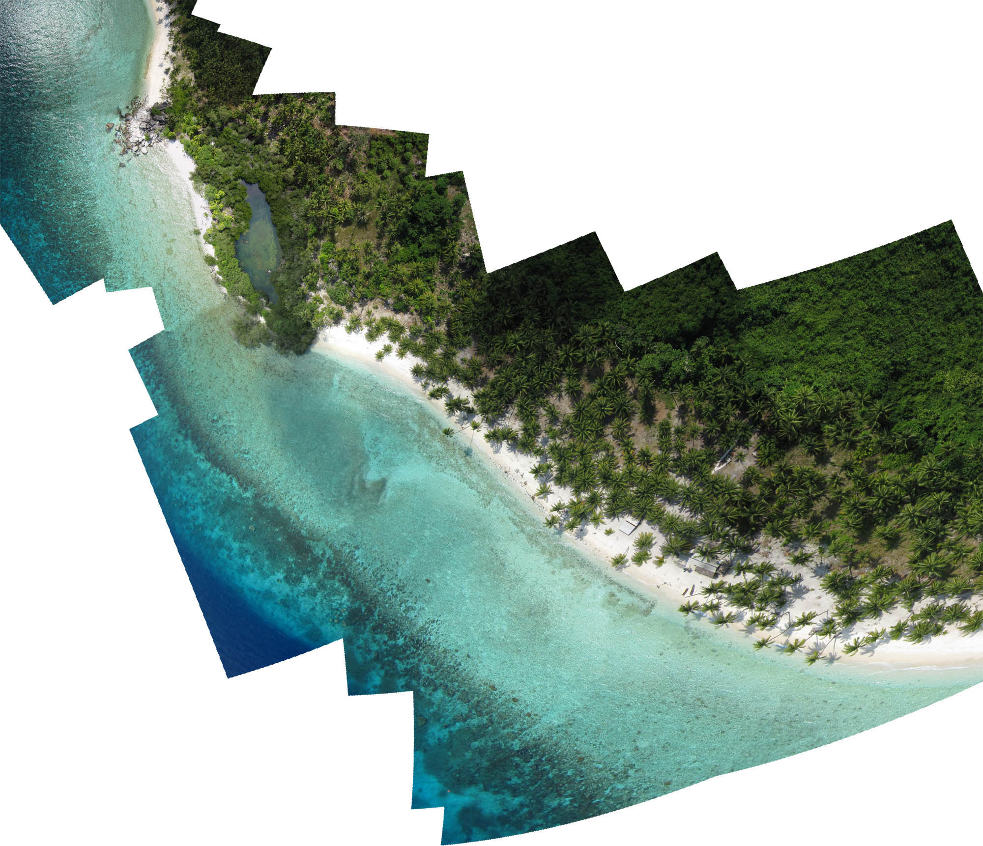
The effort produced around 1500 photographs, now in the process of being sorted and pieced together to create a composite aerial image covering about half of Durai’s coastline. We will combine this image with the ground control points to create a basemap that we hope to relate to the in situ observations on reef morphology. Sifting through the photographs, I’m already looking forward to my next trip to Durai…and more of Pak Lahanie’s coconuts!
Editor’s note: Thanks to Kitty for this article and the accompanying photos. See the June 3 article “Kitty Currier Is Flying High” for more about kite aerial photography in general and Kitty’s research in the Anambas Islands in particular.