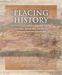
A recent New York Times article titled “Digital Maps Are Giving Scholars the Historical Lay of the Land” explores a new academic field known as “Spatial Humanities” that uses “Historical Geographic Information Systems” (HGIS) for research. “Historians, literary theorists, archaeologists, and others are using Geographic Information Systems — software that displays and analyzes information related to a physical location — to re-examine real and fictional places like the villages around Salem, Mass., at the time of the witch trials; the Dust Bowl region devastated during the Great Depression; and the Eastcheap taverns where Shakespeare’s Falstaff and Prince Hal caroused.”
According to the Historical GIS Network, “although GIS originated in the Earth Sciences, since the 1990s its use has increasingly spread to historical research such that the field has become known as Historical GIS. One of the original manifestations of this spread was the creation in a number of countries of National Historical GISs such as the Great Britain Historical GIS and the US National Historical GIS. These are systems that hold changing administrative boundaries linked to census and other data published using them. They usually cover most of the nineteenth and twentieth centuries. Increasingly, GISs have focused on much smaller areas and on more qualitative sources. Good examples of these include the Valley of the Shadow project and the Salem Witchcraft project. Both of these projects created large archives on two counties on the eve of the American Civil War (the Valley of the Shadow) and the village of Salem, Massachusetts around the time of the witchcraft trials. Both independently saw the need to add a GIS component to their archive, partly to help structure the data and also because they realized that geography was important to their understanding of their research questions.”
The Times article cites the example of using HGIS to evaluate decisions made by General Robert E. Lee during the Civil War. “‘Mapping spatial information reveals part of human history that otherwise we couldn’t possibly know,’ said Anne Kelly Knowles, a geographer at Middlebury College in Vermont. Today visitors to Gettysburg can climb to the cupola of the Lutheran seminary, where Lee stationed himself on July 2, the second day of fighting; or stand on Seminary Ridge, where the next day Lee watched from behind the Confederate lines as thousands of his men advanced across the open farmland to their deaths in the notorious Pickett’s Charge. But they won’t see what the general saw because the intervening years have altered the topography. Over the decades a quarry, a reservoir, different plants and trees have been added, and elevations have changed as a result of mechanical plowing and erosion…
GIS allowed Ms. Knowles and her colleagues to recreate a digital version of the original Gettysburg battlefield from historical maps, documented descriptions of troop positions and scenery, and renderings of historic roads, fences, buildings and vegetation. ‘The only way I knew how to answer the question,’ about what Lee saw, Ms. Knowles said, ‘was to recreate the ground digitally using GIS and then ask the GIS program: What can you see from a certain position on the digital landscape, and what can you not see?’” She said her work helps “make Lee’s dilemma more vivid and personal.’ Nineteenth-century military leaders relied primarily on their own eyes, and small differences in elevation were strategically important. ‘Lee probably could not have possibly seen the massive federal forces building up on the eastern side of the battlefield on Day 2 during the famous attack on Little Round Top,’ Ms. Knowles said. ‘He had to make decisions with really inadequate information.'”
Editor’s note: Many thanks to alumnus Tom Traeger (BS, 2000) for bringing this information to our attention. Tom teaches Earth Science at La Canada High School near Pasadena (Tom’s web site).


