Professors Mike Goodchild (PI) and Martin Raubal (Co-PI) just received a substantial grant from the National Geospatial Intelligence Agency (NGA). The project is titled “Geospatial Feature Conflation: Conceptual, Statistical, and Optimization Approaches” and was obtained through the very competitive NGA University Research Initiatives (NURI) program. Their funding is $ 288,548 for 2 years, with the potential of a renewal for another 3 years after that. This will result in two graduate students being employed in this project, one of whom will be Linna Li, whose PhD topic is on conflation.
The research will provide a theoretical foundation to the integration of incompatible geospatial data. The increasing and rapid development of remote sensing and other technologies, as well as the growth of the Internet, provide abundant opportunities to collect and access vast volumes of geospatial data. In addition to well-known datasets provided by the government, such as US Census TIGER/Line files, and free data services, like Google Earth, large amounts of geospatial information are being generated by individuals all over the world every day, which creates an increasingly extensive net of volunteered geographic information. Large volumes of geospatial data have the potential to benefit scientific research, decision making, and everyday life. However, it is not always easy to take advantage of this abundance, due to inconsistency, incompatibility, and heterogeneity among various datasets.
Conflation of heterogeneous datasets opens possibilities for updating, averaging to obtain better estimates, and analysis and modeling. In this project, we propose to design a relational-algebra framework for conflating geospatial data from diverse sources; to develop statistical and optimization approaches for multi-source data integration; and to develop new methods of spatiotemporal reasoning. The research will extend across different time instants and different data standards. The findings of this project will not only meet the requirement of creating higher-accuracy data from multiple sources, but also will offer a new direction for utilizing rich yet incompatible geospatial data in order to facilitate spatial reasoning.
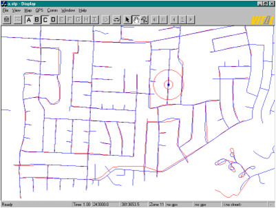
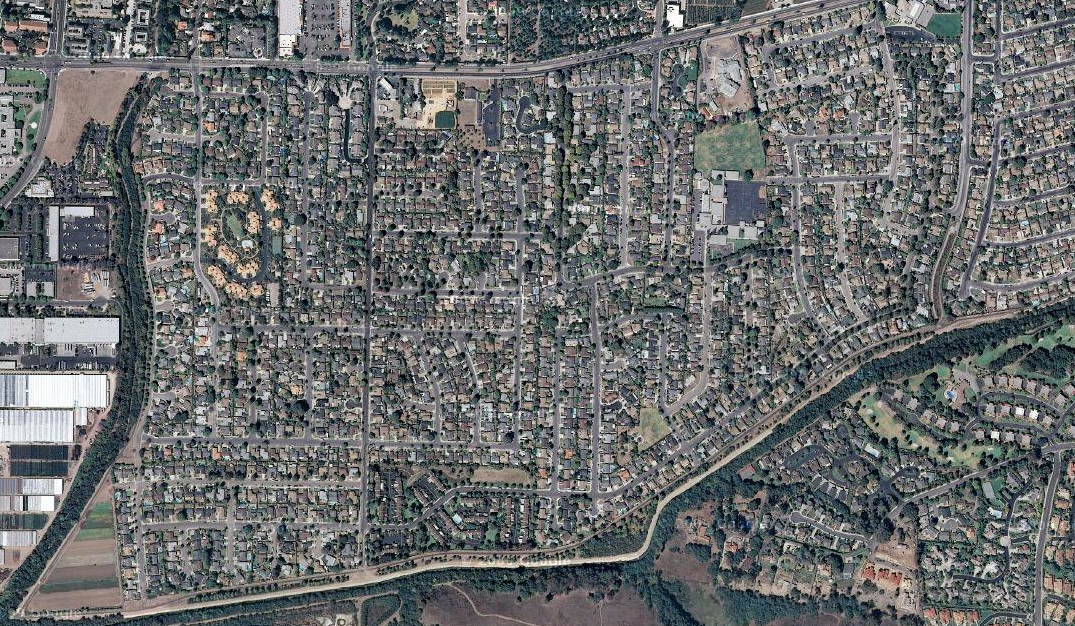
A good everyday example is the conflation of two street data sets for a particular region to be used in a navigation service. The attached graphics depict two maps (one before conflation and one after the conflation process) and the corresponding real-world image (images provided by Linna Li).
Thanks to Prof. Raubal for providing the information for this article