It is often remarked that knowledge is power, but through its collaboration with the Famine Early Warning Systems Network (FEWS NET), UCSB Geography Department’s Climate Hazards Group (CHG) seeks to turn knowledge into food.
For the past several years, the CHG has been working with FEWS NET to build a global network of data collection and to develop data analysis tools designed to help decision makers and stakeholders mitigate or prevent famines caused or exacerbated by climate hazards such as drought or flooding. FEWS NET consists of field scientists from Africa and Central America collaborating with research scientists at UCSB (CHG), US government agencies, national government ministries, and international partners all coming together to share data and develop tools for data analysis. The CHG’s innovative, multi-disciplinary approach incorporates not only climatological factors (such as satellite and station data), but also population dynamics (such as population density and demographics), phenological information (including vegetation coverage and start-of-season water resources), and economic factors (such as price behavior and a given market’s resiliency to supply/demand shocks).
CHG was recently awarded another five-year grant working in conjunction with US Agency for International Development’s (USAID) FEWS NET. The cooperative agreement, entitled “Identification of Seasonal and Decadal Drought Through Monitoring and Modeling,” proposes to expand upon the CHG’s current work detecting low frequency shifts in climate variables that may provide predictive power regarding seasonal rainfall and temperature expectations. The research in this emerging field largely focuses on the development and application of techniques which can improve identification of conditions impacting the physical variables governing crop growth, such as the timing and amount of precipitation, evapotranspiration, and temperature. Human-related factors such as cropped area, agricultural inputs, and economic indicators are also considered. The tools and techniques developed by this research aim to reduce the severity of outcomes resulting from food insecurity in the developing world. The research for this grant will center around capacity building and outreach for these areas as well as the tools and training to support the advanced identification and quantification of food security shocks resulting from weather and climate conditions.
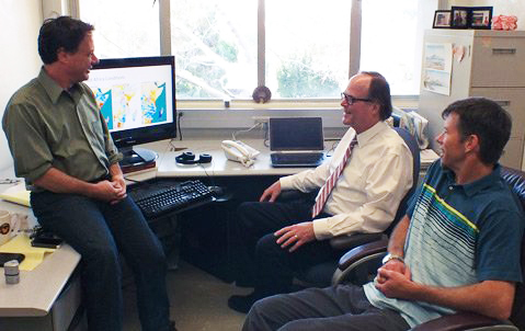
The CHG’s four field scientists are crucial to its success. Tamuka Magadzire (Botswana), Gideon Galu (Kenya), Mario Rodriguez (Guatemala), and Alkhalil Adoum (Niger) have all been working with the CHG for many years, and their expertise and connections within their respective regions enrich the resources of the CHG, including the gathering of data and data analysis product development. Two other regional scientists will be hired in conjunction with this grant to further the reach of the CHG’s data driven mission, as well as an Outreach Specialist seated in Nairobi who will be responsible for identifying and informing stakeholders and decision makers with a direct interest in the CHG’s research.
Within the CHG, Dr. Greg Husak will be responsible for the administrative and scientific management of the project. In addition, he will conduct forecasting and risk analysis and contribute to the development of new monitoring tools. Dr. Joel Michaelsen, professor of climate science at UCSB, will provide support for the statistical and scientific direction of the project, assistance with the rainfall station database, and assistance with trend analysis and forecasting activities. Based on the East Coast, Dr. Andrew Hoell will concentrate on climate adaptation activities and risk analysis research. Dr. Frank Davenport will act as a specialist dedicated to carrying out climate modeling and decadal forecasting. The CHG retains two scientific programmers, Pete Peterson and Marty Landsfeld, who are tasked with improving and updating the climate database, developing and quality controlling new rainfall datasets, and developing new web-based interfaces for exploring the suite of data products produced as part of this project. Two grad students, Laura Harrison and one other yet to be named, will investigate temperature impacts on phenology and assist in adaptation strategies to respond to climate trends.The CHG will also be acquiring new team members: one to coordinate climate trend outreach in the Lake Victoria basin, one to work with the integration of Land Surface Models (LSMs) in FEWS NET activities, and one part-time lab assistant for low-level data organization and other activities.
The CHG has developed a variety of data analysis tools, many of which transition into the core monitoring activities performed by FEWS NET. These tools, including the GeoWRSI and Early Warning Explorer (EWX), represent both the innovative science being done at UCSB as well as the applied nature of that science and how to craft it in a way that is responsive to the needs of the food security monitoring community. Another such tool is the GeoCLIM, a climatological analysis tool developed by Tamuka Magadzire, intended for analysis of historical rainfall and temperature data.
In October 2013, the CHG had the pleasure of training three regional core-trainers from ICPAC, University of Nairobi, and FEWS NET. Those three core-trainers went on to train 15 national trainers from national meteorological services in Kenya, Uganda, Sudan, South Sudan, Tanzania, Rwanda, Burundi, and Djibouti. Subsequently, 10 Kenya Meteorological Services personnel were trained to implement the GeoCLIM at a national level. As a result, over 300 rain gauge stations have been incorporated in the Kenya rainfall gridded datasets. Similar national training is planned for Uganda, Rwanda, Tanzania, and Burundi before the end of April 2014. It is this model of information dissemination and local decision maker and stakeholder empowerment that is central to the CHG’s goals.
In addition to capacity building and outreach such as this, the CHG plans to use this grant to focus climate and phenologic modeling, precipitation and temperature forecasting, climate adaptation, development of new monitoring tools, disaster risk reduction, and data services. The CHG seeks to expand on current USGS climate and phenologic modeling to include more regions of Africa, Central America and the Caribbean, and, potentially, the globe.
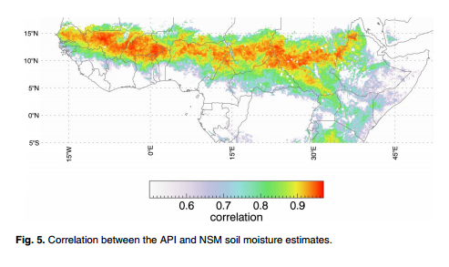
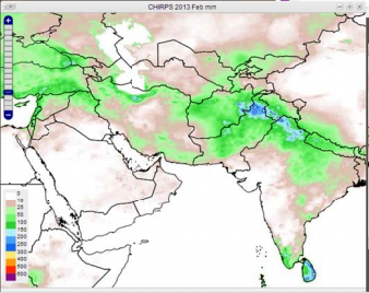
For this grant, the CHG will focus on the response of maize production in Kenya to climate stress varies over geographic regions. The Decision Support Interface (DSI), developed by Dr. Husak, will also play an important role. The DSI integrates rainfall and NDVI measures, along with seasonal timing to present the drought severity in a single index. Central to the CHG’s operations is its unique suite of data products available for USAID’s implementing partners to use for their own purposes, including a few different versions of gridded rainfall products (CHIRP, CHIRPS) which leverage available input data in order to create the best, consistent rainfall using satellite and rain station measurements.
Additionally, a station database composed of over 1.1 billion publicly available station measurements has been curated. These data serve as integral inputs into the previously mentioned data products, but also allow for quality control of other products and verification of growing conditions. Quality controlling these data for errors is also an integral part of the database, and has revealed some enlightening issues in the available data, much of which is used as input into other products.
Editor’s note:
- Special thanks to Libby White, Web Master/IT Admin/Data Curator for the CHG, for contributing this article. Libby’s communication skills are as impressive as her computer savvy. She was a Chinese major and Linguistics minor as a UCSB undergraduate, and she was pursuing a job in international relations at that time – little did she know then that she would end up actively influencing international issues with her work in the Climate Hazard Group. Hats off to a lady of many hats!
- The admirable work carried out by the CHG was also recently featured in the Santa Barbara Independent.


