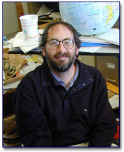
A partnership agreement between UCSB and a private Santa Barbara company, Terra Image USA, was signed on June 20th, and, according to UCSB scientists, it will have a major impact on research that utilizes satellite imagery. Keith Clarke and David Siegel were among the university leaders in this collaboration.
“We’re very excited that more than 40 UCSB faculty members, and many more of their students, doing research that utilizes satellite imagery, will have virtually unlimited access to high spatial resolution commercial satellite imagery, a research asset that has previously been available to universities in very limited quantities,”said David Siegel, professor of geography and director of UCSB’s Institute for Computational Earth System Science (ICESS), the lead university institute involved in the partnership.
“UCSB, like most other universities, has had to rely upon mostly low resolution data sets, such as what NASA provides, which have a resolution of one kilometer per pixel,”said Siegel. “What we’re getting from Terra Image USA has a resolution 400 times higher, which is comparable to aerial photography and allows one to view and study buildings, trees, cars, and the impacts people make on the Earth. UCSB is already considered among the world’s leaders in remote sensing science. Now, with this unprecedented access to high spatial resolution imagery, whole new frontiers of research have been opened for us.”
Terra Image USA, LLC has been named the exclusive distributor of SPOT satellite imaging products and services. Under its new role, TI-USA will share responsibility for market development and sales to the U.S. Department of Defense and commercial markets, including government entities and universities, and it will benefit from its UCSB partnership through the promotion of SPOT data for research and the training of future usersof SPOT data. The SPOT (Satellite Pour l’Observation de la Terre) remote-sensing program was set up by France in partnership with Belgium and Sweden in 1986 and is the oldest and most prestigious commercial satellite imaging company in the world. There have been 5 SPOT satellites (three of which are currently functional)—the first one was launched 1986 and the last one 2002. The constellation of SPOT satellites in orbit makes it possible to acquire medium to high resolution imagery of almost any point on the globe in one day.
Siegel expects to see many new uses of SPOT imagery by UCSB and other university researchers. SPOT can supply images for a wide range of applications, including mapping, natural resource management, harvest forecasting, territorial development and management, geology, pollution control, etc. “If a volcano erupts or a fire starts, we can request that a satellite be tasked to collect images of that event,”said Siegel. Besides current satellite images, researchers will be able to access archival images as far back as 1986, when SPOT first began collecting images. SPOT images will be useful to UCSB researchers in many departments, including geography, marine biology, geology, and computer science. Spot images will also benefit the Map and Imagery Library, the School of Environmental Science and Management, the Institute for Crustal Studies, and the Marine Science Institute.
Dr. Siegel’s research interests include Interdisciplinary Oceanography—specifically, bio-optical oceanography, satellite ocean color remote sensing, physical and radiative forcing of ocean biogeochemistry, numerical simulation of small-scale oceanic motions, radiative processes in air-sea interactions, mesoscale and submesoscale eddy processes, data information and analysis systems, and spatial interactions in population systems.


