The Climate Hazards Group (CHG) in the Geography Department is wrapping up a 5-year agreement with the US Geologic Survey as part of the Famine Early Warning System Network (FEWS NET), and preparing for a new grant to build on the foundation built in the first cycle of the project at UCSB. The CHG monitors atmospheric, terrestrial, and social processes which affect food availability throughout the developing world.
The cornerstone of the CHG team is a group of scientists located in the field who are responsible for interfacing with local government agencies, sharing tools developed at UCSB, building local capacity, and providing a conduit of information between domestic and foreign scientists and decision-makers. The field scientists are placed in regional offices in West Africa (Niger), East Africa (Kenya), Southern Africa (Botswana), and Central America (Guatemala). These regional scientists have been responsible for training hundreds of local experts in GIS, remote sensing, and crop monitoring tools in an effort to improve the capacity of local agencies to make dependable estimates of crop production, water availability, and food needs. In addition to training, these scientists are also responsible for development of cutting-edge analysis in such things as market forces on food needs, rainfall forecasting, crop yield scenarios, and the creation of new software allowing users to customize crop model inputs to reflect local conditions.
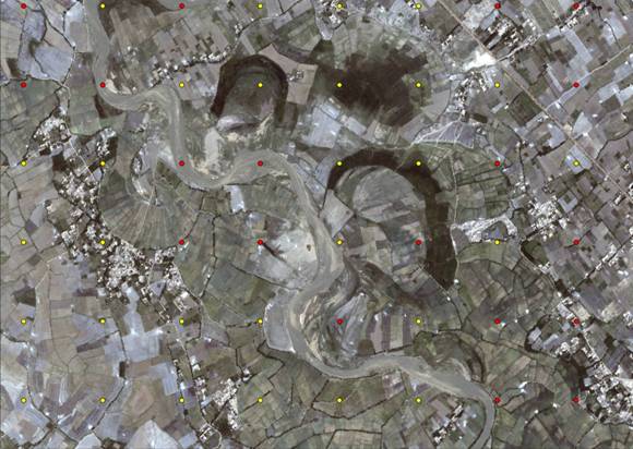
On the UCSB campus, the group is headed by Professor Joel Michaelsen and consists of three graduate students (Laura Harrison, Michael Marshall, and Diego Pedreros) and two researchers (Greg Husak and Chris Funk; Chris recently began working full time for the USGS). This group provides science support to the field scientists as well as developing new lines of research related to various aspects of climate or food security in the developing world. Examples of the types of research include the development of new techniques for leveraging satellite data to produce more realistic estimates of rainfall in Central America; the development of new evapotranspiration estimates to better capture vegetation processes; and incorporating the effects of extreme temperature on crop yields. One of the pioneering works developed in the last year is the estimation of cropped area in specific regions using high resolution satellite data. These studies have been performed for Ethiopia, Zimbabwe, Niger, and Afghanistan and have piqued the interest of funding agencies seeking to expand the scope of this work in the coming years. Eye-catching work has also investigated the effects of a warming Indian Ocean on rainfall in the Greater Horn of Africa and the needs of the expanding population in Ethiopia. This work was published in the Proceedings of the National Academy of Science.
Looking ahead, the Climate Hazards Group is about to embark on a new five-year grant with the US Geologic Survey. This grant continues the monitoring activities that have been the staple of the project over the last five years at UCSB, and it also encourages the development of new monitoring tools, software applications, and forecasting techniques to help reduce the uncertainty in food production estimates. This work is influential in reducing the costs of food relief and preventing malnutrition of millions in the developing world by better targeting food aid and anticipating food shortages.
Editor’s Note: Thanks to Greg Husak for contributing this article. It’s an honor and a privilege to work for a department that produces such professional and humanitarian efforts.

.JPG)


.jpg)
