The following is a University of Maryland news release, dated August 1, 2014 and titled “UMD/NASA Goddard Instrument to Fly on Space Station: Technology Enables U.S. to Monitor Forest Carbon from Space Station”:
NASA has selected a proposal developed by the University of Maryland and NASA Goddard Space Flight Center (GSFC) for a new instrument that will join a growing suite of technologies deployed on the International Space Station (ISS), providing key observations about the Earth’s environment. The new instrument will provide unprecedented observations of the Earth’s forests and their response to changes in climate and land use.
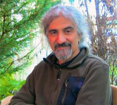
“GEDI will provide the first global data set on forest structure sufficient to accurately map forest above-ground carbon. These data can then be used to estimate the emission of CO2 into the atmosphere that occurs from forest loss, say through fire, and the sequestration of CO2 from the atmosphere as forests grow,” said UMD Department of Geographical Sciences Professor Ralph Dubayah, the Principal Investigator of the project.
The Global Ecosystem Dynamics Investigation (GEDI) Lidar will use a system of laser beams to map the three-dimensional structure of vegetation, including canopy heights, over a range of biomes including the temperature forests of North America, and tropical regions where rapid deforestation is occurring. GEDI offers scientists the means to answer key questions, including: 1) How has deforestation contributed to atmospheric CO2 concentrations? 2) How much carbon will forests absorb in the future? 3) How will habitat degradation affect global biodiversity?
“By far, the largest uncertainties in the global carbon cycle concern the net impact of forest disturbance and subsequent regrowth on atmospheric CO2. Without these data, we cannot accurately predict future global warming, nor its consequences, such as sea-level rise. Nor can we accurately project the impact of potential policy actions to mitigate warming, such as planting trees or reducing deforestation,” Professor Dubayah said.
Forest loss is also driving habitat degradation and erosion of biodiversity. “We are only now beginning to understand the relationship of canopy structure, how the leaves and branches are arranged vertically, to habitat quality and biodiversity,” Dubayah said. “For example, many avian species have strong preferences for certain types of forests, such as those with little understory. What happens when we disturb these forests or the climate regime changes? We have very little data on vertical canopy structure globally and therefore we are limited in our ability to answer such questions. GEDI Lidar will provide billions of canopy profiles from which we can deepen our understanding of how habitat degradation drives the loss of biodiversity, and how we may mitigate its impacts.”
GEDI will be completed in 2018 for a cost of $94 million. Upon deployment on the ISS, data from GEDI will be used create a variety of products, including canopy height and structure, forest carbon and its changes. In addition, these data will be used drive global ecosystem models to assess the impacts of changes in land use on atmospheric CO2 under various future climate scenarios.
Professor Dubayah said the GEDI team is confident their investigation will have a significant impact on U.S. environmental policy both domestically and abroad. “On a national policy level, GEDI strongly informs U.S. participation in international climate frameworks and treaties such as Reducing Emissions from Deforestation and Degradation [Redd+],” Dubayah said. “And for the first time, GEDI also provides the United States with a mechanism to monitor forest carbon from space that can be used to help verify potential treaty accordances, such as those which make payments to countries who preserve their forests and related resources.”
The GEDI UMD/NASA team has unique technological capability and experience to make these urgently needed measurements with the required fidelity and resolution. They further have a long and extensive background in observing and modeling forest and vegetation dynamics. Dubayah is an expert in using lidar remote sensing observations to characterize forest ecosystem structure to better understand the carbon cycle, habitat quality, and biodiversity and has led numerous such investigations from sub-orbital platforms throughout his career. He is joined at UMD by Co-Investigators, including Professors Matt Hansen, George Hurtt, and Research Assistant Professor Anu Swatantran.
GSFC is the world lead in laser-based remote sensing for both Earth and planetary science and will be responsible for constructing and delivering the instrument, under the guidance of Deputy PI J. Bryan Blair and others. GSFC earth scientists will also participate in the development of the mission and analysis of the science data.
The GEDI team includes Co-Investigators from Woods Hole Research Center, Woods Hole, Massachusetts; the U.S. Forest Service, Ogden, Utah; and Brown University, Providence, Rhode Island. GEDI additionally has formal collaborations in place with the German Space Agency, the European Space Agency, the Canadian Forest Service, the U.S. Geological Survey, the University of Massachusetts Boston, NASA Jet Propulsion Laboratory, the World Wildlife Fund, and Conservation International.
Editor’s note: Many thanks to Research Support staffer Pete Peterson for bringing this material to our attention.