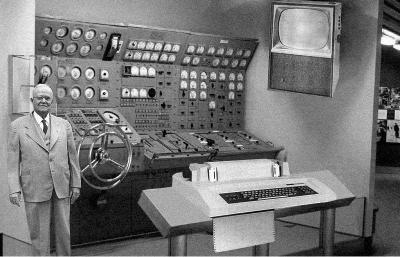
In “The Department of Geography at the University of California, Santa Barbara: History, Curriculum, and Pedagogy,” Keith Clarke and Susanna Baumgart describe the advent of computing at the UCSB Department of Geography (photo from
The Jeffrey Dozier and Alan Strahler team taught the first department computer course in spring 1975: Geography 170, “Univariate Statistics.” The course used an IBM mainframe, a PDP-11 minicomputer, and remote terminals. A group of students, including undergraduate Jim Frew, cleared out some space acquired by Simonett, an unused laboratory in the Engineering building that happened to be next to a computer running UNIX. Dozier and Frew taught themselves how to use this early machine. Frew recalls that “this is where the computerized aspect of the department [research] took off.”
Beyond the statistics group, early computing support was weak at best. Tobler described the UCSB computing environment when he arrived in 1977:
When I arrived here, the computing facilities were abominable. [Chancellor] Cheadle had turned computing over to an administrator who promised to curb the rapid growth in costs that were occurring. This he did, with disastrous results. One of the professors in engineering had established an Internet-like arrangement, with interactive graphics and computing, far in advance of most other places. This was not supported by the university. It was actually squelched, and the professor in charge left. The computer administrator at UCSB let IBM dictate the type of computing available to faculty with rather awful rituals and clumsy software. I did most of my computing via telephone back to Ann Arbor on a teletype machine, using their Amdahl machine and the interactive MAD language.
Golledge, while chair, acquired two VAX 11/750 machines, one for research, one for teaching. This was, in effect, a declaration of independence from central university computing, a philosophy that has stood the test of time. The two VAXs added to the larger VAX in the Remote Sensing Research Unit, which had been in use since 1978. Faculty networked to the hulking, early UNIX machines through workstations, including some of the very first Sun workstations ever shipped, with serial numbers around “100.” The instructional machine was used for statistics courses and also for document preparation with UNIX troff, because a laser printer was hooked up to it. In addition to Geography’s VAXs, in 1980 the university made available to faculty and students a computer center with IBM 360 Model 65 clones. At this time, only a few faculty had garnered their own computers through grants.
By 1988 the department was completely weaned from the university computing system, and faculty all had either their own PC or a workstation hooked to Geography’s UNIX system. Computerization of the department changed the teaching of cartography. In 1984, student labs had been set up with drafting tables, pens, compasses, protractors, and lettering sets. By 1988, paper and pens were gone. The labs were set up with workstations and ESRI’s ArcInfo. After many years of change, the department has settled on a strategy of two large teaching laboratories, one based on Intel and Windows, and one based on UNIX workstations. Most graduate students are assigned offices and their own computers of choice, usually purchased on research projects and grants. The UNIX laboratory, called the Descartes Laboratory, was funded with assistance from the NSF’s Instrumentation and Laboratory Improvement program. The department continues to support extensive suites of software, including ESRI’s ArcInfo, ENVI, ERDAS, MATLAB, and many others.
From Clarke, K. C., & Baumgart, S. (2004). The Department of Geography at the University of California, Santa Barbara: History, curriculum, and pedagogy. In Yearbook of the Association of Pacific Coast Geographers (pp. 95-113): University of Hawai’i Press. The complete article is available at http://muse.jhu.edu/journals


