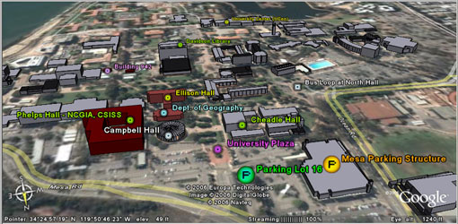
Dylan Parenti, a Computer Network Technologist in Professor Dar Roberts’ Advanced Remote Sensing Group (the Viper Lab), created the accompanying campus maps to help those of us who are “spatially challenged.” Starting with a Google Earth model developed last winter by grad student Karl Grossner, Dylan modified some points, added others, and generated these oblique views of the northeast end of the UCSB campus. The resulting maps are a major asset for anyone asked to explain how to find the UCSB Department of Geography! Click on the images for an enlarged view.
Karl’s “UCSB Geography in Google Earth” project includes campus buildings derived from individual 3D models developed by grad student Ryan Aubry a few years ago. Along with buildings, it includes GIS layers from Jeff Hemphill‘s South Coast Land Use research (with a short movie!) and a modest “tour” of some faculty research locales. More on that work in progress can be found at https://legacy.geog.ucsb.edu/virtualglobes/gemodel.html.


