The year 2010 has been a benchmark year for the geographic realm of ocean processes. The British Petroleum oilrig blowout in the Gulf of Mexico and the ensuing ecological disaster received most of the mainstream media attention, and its implications regarding international policies governing the exploitation of deep water petroleum resources, in particular, and its impact upon marine life, in general, remain uncertain. Ocean acidification, the proliferation of “trash islands,” and the global decline of coral reefs and fisheries are also major concerns. However, year 2010 also witnessed some remarkable innovations, advances, and discoveries in all things oceanographic.
Regarding advances, “the Integrated Ocean Drilling Program bored into the gabbroic layer, beginning at the ocean floor in the mid-Atlantic, where seismic forces have pushed the target layer to within hundreds of feet of the seabed. Researchers from Oregon State University found unique types of bacteria there which feed off hydrocarbons, such as methane and benzene, and they believe that organisms may be present at even much greater depths. The findings are published in the journal PLoS ONE.”
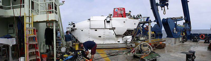
Speaking of greater depths, “Alvin, the nation’s deepest diving research submarine, is being overhauled. If things go as planned, it will be able to dive to over 6,500 meters, 2,000 more than its current depth accessibility. That will extend the amount of the sea floor that the sub can explore from 68% to 98%, leaving only the deepest sea trenches beyond the view of human eyes” (source).
Recent observations from Europe’s Goce (Gravity field and steady-state Ocean Circulation Explorer) gravity mapping satellite have allowed scientists to plot ocean currents with unprecedented precision. “Understanding gravity is fundamental to being able to track the direction and speed of water across the globe; the data should improve the climate models used to represent how oceans move heat around the planet” (source).
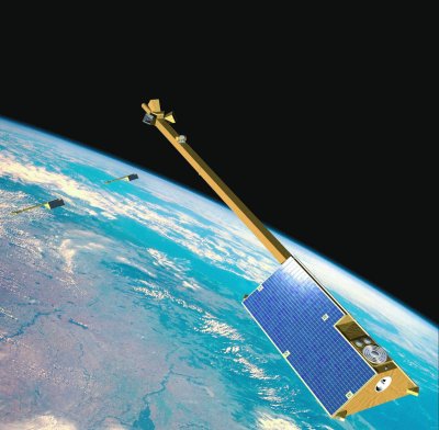
European scientists are also going to try to measure the movement of the oceans by tracing their magnetism alone. “The effort will be achieved using three super-sensitive spacecraft called Swarm, which should launch in 2012. The magnetic signal of the tides sweeping around the globe has been seen before, but the new mission would aim to observe far more detail. It should provide additional data on how the oceans transfer heat around the Earth, a key feature of the climate” (source).
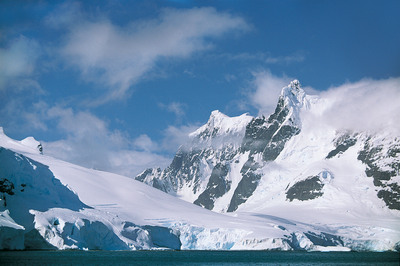
The European Space Agency’s Cryosat-2 spacecraft has produced its first major science result, using radar data to create a map of ocean circulation across the Arctic basin. Cryosat’s primary mission is to measure sea-ice thickness, which has been in sharp decline in recent decades. The ability to map the shape of the sea surface will tell scientists if Arctic currents are changing as a result of winds being allowed to blow more easily on ice-free waters: “Nobody really knows how the Arctic is going to behave as the ice retreats, but we do anticipate that significant changes will occur,” said Dr Seymour Laxon, a Cryosat science team member from University College London, UK. “This is just the first data, and it shows we now have the tool to monitor what is happening” (source).
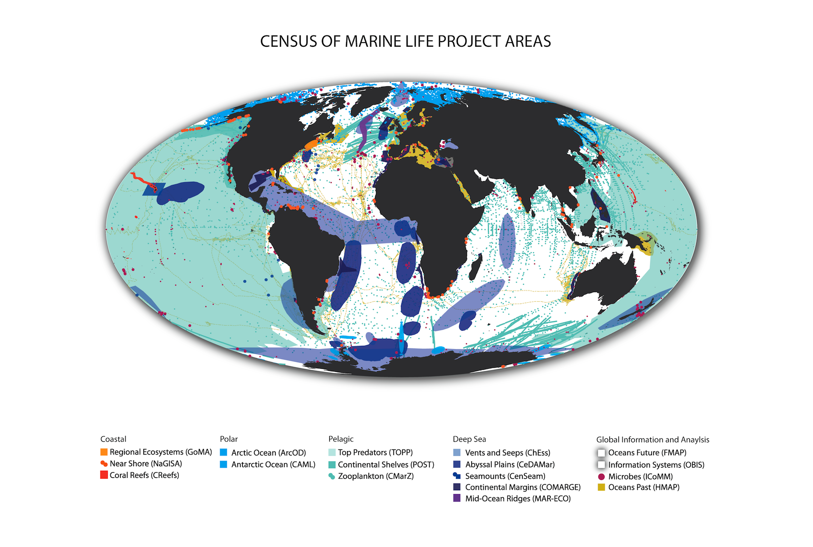
Perhaps the greatest oceanic advance of year 2010 is the first Census of Marine Life (CoML), the culmination of 10 years of exploration and research by 2,700 scientists from 80 different nations. The report, released in August, is a benchmark attempt to reveal what, where, and how much lives and hides in global oceans, to measure changes caused by climate or oil spills, to document the discovery of new species and the diminished abundance of others, to map marine highways and rest stops, and to allow anyone to map the global addresses of species.
“Scientists combined information collected over centuries with data obtained during the decade-long Census to create a roll call of species in 25 biologically representative regions — from the Antarctic through temperate and tropical seas to the Arctic. Their papers help set a baseline for measuring changes that humanity and nature will cause. Published by the open access journal PLoS ONE, the landmark collection of papers and overview synthesis (Marine Biodiversity and Biogeography— Regional Comparisons of Global Issues) will help guide future decisions on exploration of still poorly-explored waters, especially the abyssal depths, and provides a baseline for still thinly-studied forms, especially small animals.” See the full press release here and check out the CoML website here.
UCSB Geography has three faculty members who specifically target ocean processes as their research areas. These include:
- Tommy Dickey (PhD, Princeton University, Geophysical Fluid Dynamics, 1977) who focuses on atmosphere-ocean interactions and upper ocean mixing, turbulence and internal waves, bio-optics, biogeochemistry, and biological-physical interactions.
- David Siegel (PhD, University of Southern California, Geological Sciences with a specialty in Ocean Physics, 1988) who specializes in interdisciplinary oceanography investigating physical, biological, optical and biogeochemical couplings on micro to ocean basin scales. Specifically, satellite ocean color remote sensing and optical oceanography, scale interaction in ecological and population systems, role of radiative exchange in air-sea interactions, and data information system biogeosciences, ocean processes, and remote sensing.
- Libe Washburn (PhD, University of California, San Diego, Engineering Sciences and Fluid Mechanics, 1982) whose research is concerned with coastal circulation, mesoscale processes, air-sea interaction, and interdisciplinary oceanography.
- (See the UCSB faculty listing for a quick rundown of Geography faculty’s education, areas of interest, and contact information.)