Soil Biogeochemistry - Amazon
Collaborations: Researchers from the various institutions listed below are working on this project with the support of a NASA-LBA Ecology grant. These institutions include: the University of California, Santa Barbara (UCSB), USA; Instituto de Pesquisas Espaciais (INPE), São Jose dos Campos, São Paulo; Centro de Energia Nuclear na Agricultura (CENA), Universidade de São Paulo, Universidade Federal, Porto Velho and Ji-Paraná, Rondônia; Centro de Pesquisas de Recursos Minerais (CPRM), Porto Velho, Rondônia; Empresa Brasileira de Pesquisa Agropecuária (EMBRAPA), Porto Velho, Rondônia.
Background: In the tropics, ecosystems in equilibrium (on time scales of 103 to 104 years) have developed efficient methods of recycling essential nutrients. High temperatures and abundant moisture in the tropics cause rates of litter decomposition and mineral weathering to increase, and most nutrients, once in solution, are readily leached from the soil. The tectonic stability of the majority of the Amazon Basin means that soils have experienced this intense chemical weathering for a very long time. The southern and northern portions of the Basin are on the Brazilian and Guyanian shields, which have remained relatively tectonically stable for hundreds of thousands of years. The present shape of the landscape, or topography, is in dynamic equilibrium between those forces driving erosion (transport of material by water, wind, gravity, etc.) and those forces resisting erosion (coherence of bedrock). Soil develops at the boundary between atmosphere and solid earth, and provides the sub-surface structural support, water storage, and rock-derived nutrient supply for vegetation growth, but in humid environments soils slowly lose nutrients through leaching.
Over a long period of time with no major tectonic change, the zone of weathering at the earth’s surface grows thicker and thicker, and topography is modified. Soils covering the surface also reflect changes in surficial processes, though on a shorter time-scale than the underlying topography, which controls the distribution of energy and matter across the landscape. Thus soil properties important to ecosystem maintenance (e.g. hydraulic conductivity, or nutrient availability) cannot be measured easily, but are strongly dependent on topography, which can be confidently inferred or directly mapped using remote sensing techniques.
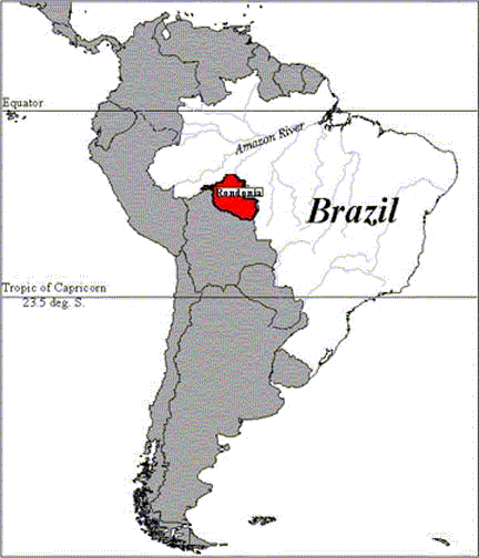
Study area: Rondônia, Brazil: More than 15% of those areas the Brazilian National Institute for Space Research (INPE) considers ‘critical’ for predicting deforestation in the Amazon lie in Rondônia, in the southwestern Amazon Basin bordering Bolivia.
Rondônia attracted an enormous number of migrants beginning in 1972 due to the combination of official land distribution plans, building and improvement of roads, higher average soil fertility than other areas of Amazônia, and increased political and economic tensions in other parts of Brazil . Scientists are now focusing on how to improve the sustainability of agricultural lands which have been deforested, and a more general look at how deforestation and regrowth cycles are affecting biogeochemical cycling, and the implications for the Amazonian ecosystem as a whole.
Approach: We are using optical and radar remote sensing products and spatial statistics to reduce the amount of necessary fieldwork used in traditional soil surveys, while generating regional scale information about how changes in land cover affect soil processes, and providing a way to predict likely changes in nutrient availability. This study will explore how the evolution of the current landscape, the geologic history, is a control on the current patterns of spatial soil variability we see today, which affect ecosystem production and dynamics of land cover change. Our plan of attack is roughly the following:
- Regional database analysis: Statistical analysis of spatial distribution of soil properties today, utilizing available soil profile and environmental datasets collected by the state of Rondônia.
- Global and spatial patterns, rather than global, for chemistry, landcover, etc.
- Landcover dynamics, human activities in relation to geographic variable distributions.
- Create meso-scale maps of soil properties, using regression tree technique (Cardille, 2000).
- Controlling processes: Piece together a geomorphic history of Rondônia, and characterize how the geologic structures and materials which are the foundation of today’s landscape affect patterns in soil attributes across the region. We are exploring different techniques for doing this work at the present time.
- Hillslope-scale patterns: Tie the literature on deep chemical weathering into this landscape-context to more directly link the process-based perspective on landform with actual levels of nutrients in the soil.
For more information concerning this project, please contact: Karen Holmes, karen@geog.ucsb.edu
Back
to Projects
![]()